The Hoarde Vintage - www.thehoarde.com
Sellers's Details
LONDON FINE ANTIQUES
Tel:
Email: [email protected]
https://www.thehoarde.com/dealers/london-fine-antiquesItem Details
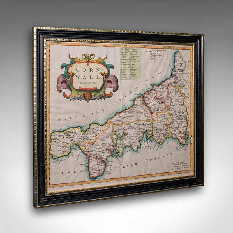
This is an antique county map of Cornwall. An English, framed atlas engraving of cartographic interest By Robert Morden, dating to the late 17th century and later.
Superb lithography of Cornwall and its county detail, perfect for display
Displaying a desirable aged patina and in good order throughout
Fascinating cartography, appealingly set within a quality, later frame
Table of Explanation and key notes add further interesting detail
Fine historical appeal, with place names written in their 17th century form
County represented by The Hundreds, the administrative divisions within counties until the mid 19th century
Mapped by Robert Morden (1650 - 1703) in high detail and hand coloured for visual appeal
Dressed to the rear with hanging cord for ease of mounting
This is a quality antique county map of Cornwall, with fine cartographic interest. Delivered ready to display.
Dimensions:
Max Width: 49.5cm (19.5'')
Max Depth: 3cm (1.25'')
Max Height: 44cm (17.25'')
Map Width: 42.5cm (16.75'')
Map Height: 37cm (14.5'')
- Period: 1700s
-
- Price: £595.00
- €695 Euro
- $794 US Dollar
- Location: Devon
-
- Dimensions: H: 44cm (17.32in)
- W: 49.5cm (19.49in)
- D: 3cm (1.18in)