The Hoarde Vintage - www.thehoarde.com
Sellers's Details
LONDON FINE ANTIQUES
Tel:
Email: [email protected]
https://www.thehoarde.com/dealers/london-fine-antiquesItem Details
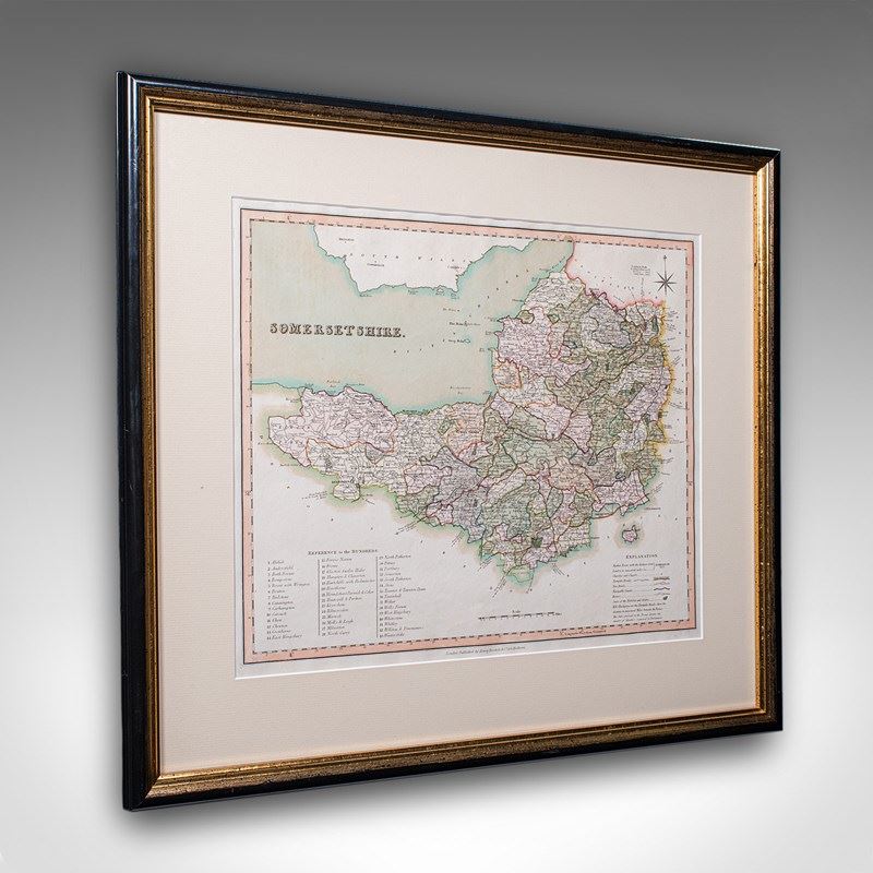
This is an antique county map of Somerset. An English, framed historical cartographic reference behind glass, dating to the Regency period, circa 1830.
Fine atlas excerpt of the county once known as Somersetshire
Displays a desirable aged patina and in good order
Set within a tasteful later frame, behind clear glass
Dressed to the rear with hanging braid for ease of mounting
Likely engraved in 1813 by Robert Rowe, this atlas edition by Henry Teesdale
This was published circa 1830 and known as 'A New British Atlas'
Hand coloured presentation, with administrative boundaries marked
Gives reference to the Hundreds, which were political areas used until the late 19th century
Also featuring a key of explanations for the roads and canals featured
This is a fascinating antique map of Somerset, ideal for county natives or cartography collectors. Delivered ready to display.
Dimensions:
Max Width: 59cm (23.25'')
Max Depth: 2cm (.75'')
Max Height: 53cm (20.75'')
Map Width: 42cm (16.5'')
Map Height: 35.5cm (14'')
- Period: 1830s
-
- Price: £495.00
- €585 Euro
- $655 US Dollar
- Location: Devon
-
- Dimensions: H: 53cm (20.87in)
- W: 59cm (23.23in)
- D: 2cm (0.79in)