The Hoarde Vintage - www.thehoarde.com
Sellers's Details
LONDON FINE ANTIQUES
Tel:
Email: [email protected]
https://www.thehoarde.com/dealers/london-fine-antiquesItem Details
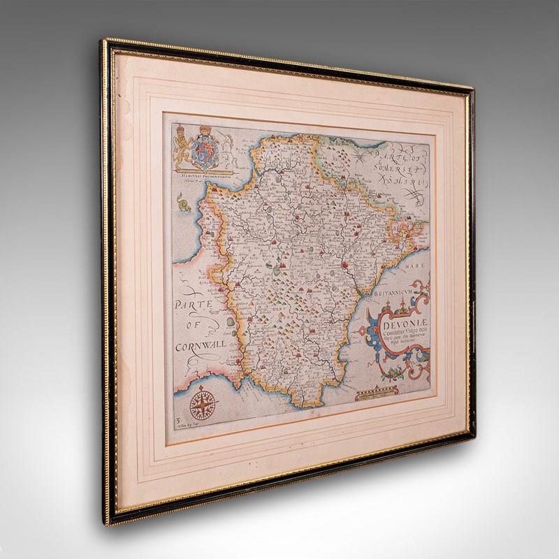
This is an antique Devon county map. An English, framed atlas engraving of Devonshire, dating to the 17th century and later, circa 1650. A fascinating and highly decorative cartographic work, presenting Devon as it appeared in the early modern period.
Antique county map of Devonshire, as published in William Camden’s Britannia
A landmark atlas, regarded as one of the first comprehensive historical and topographical surveys of Britain
Engraved by William Kip, after cartographic research by Christopher Saxton
Displays a desirable aged patina, in good order and presented behind clear protective glass
A fine example of early English county mapping and influential in shaping early understanding of the nation’s counties
Depicts Devon as it stood in the early 17th century and features period place names and regional detailing
Sought after for its blend of geography, history and heraldry and enhanced with hand coloured borders
Rich in historical and decorative interest with eye-catching heraldic embellishment
Set within a tasteful later frame with ebonised and gilt finish
Dressed to the rear with hanging wire for ease of mounting
Ideal for the study, library or country house interior
This antique county map is a superb 17th century map engraving, offering historic Devon interest and classic decorative appeal. Perfect for collectors of antique cartography or regional history delivered ready to display.
Dimensions:
Max Width: 48cm (19'')
Max Depth: 1cm (.5'')
Max Height: 44cm (17.25'')
Map Width: 35.5cm (14'')
Map Height: 31cm (12.25'')
- Period: 1650s
-
- Price: £595.00
- €686 Euro
- $787 US Dollar
- Location: Devon
-
- Dimensions: H: 44cm (17.32in)
- W: 48cm (18.90in)
- D: 1cm (0.39in)