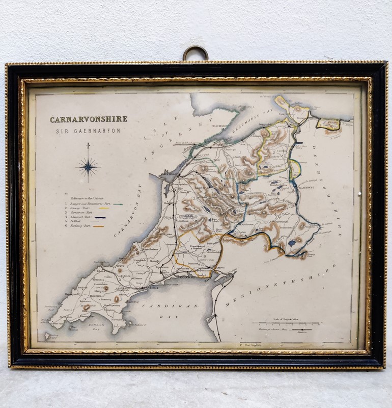
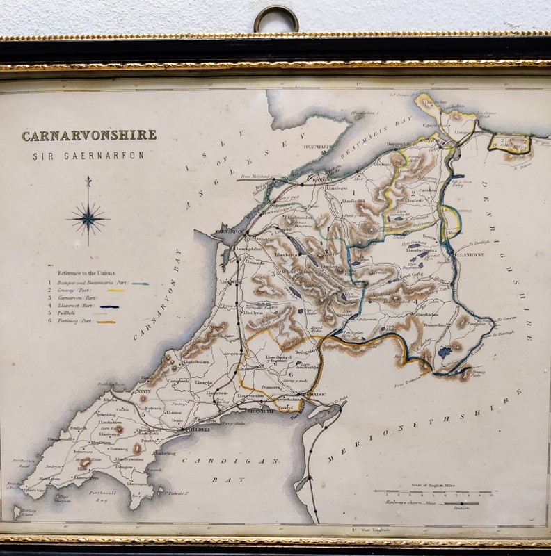

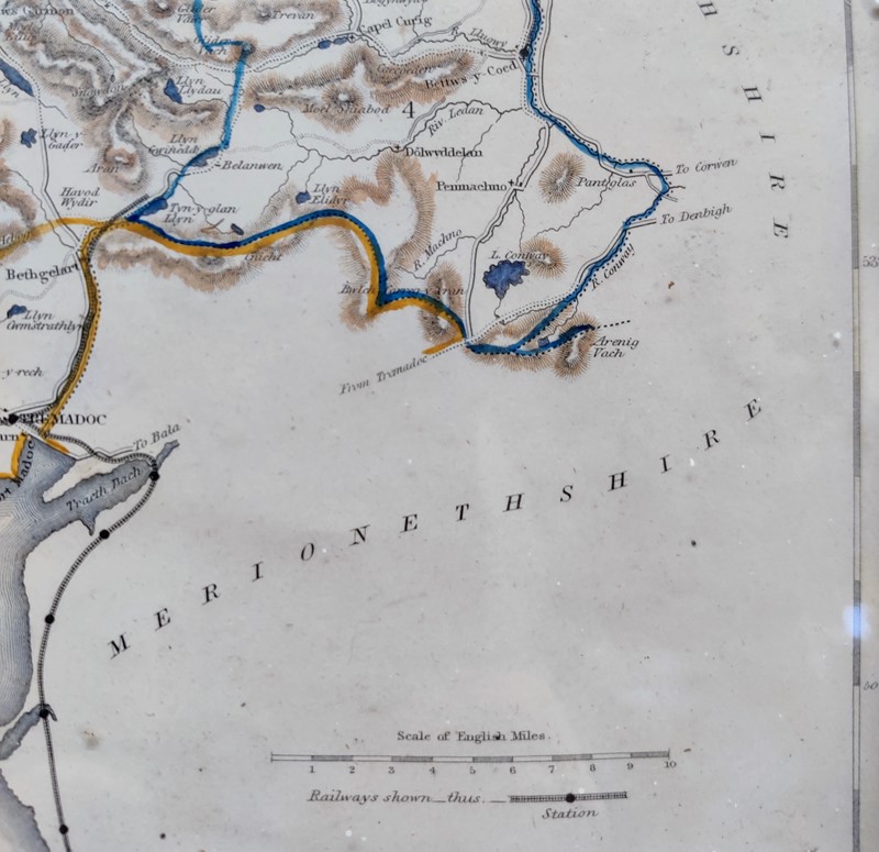


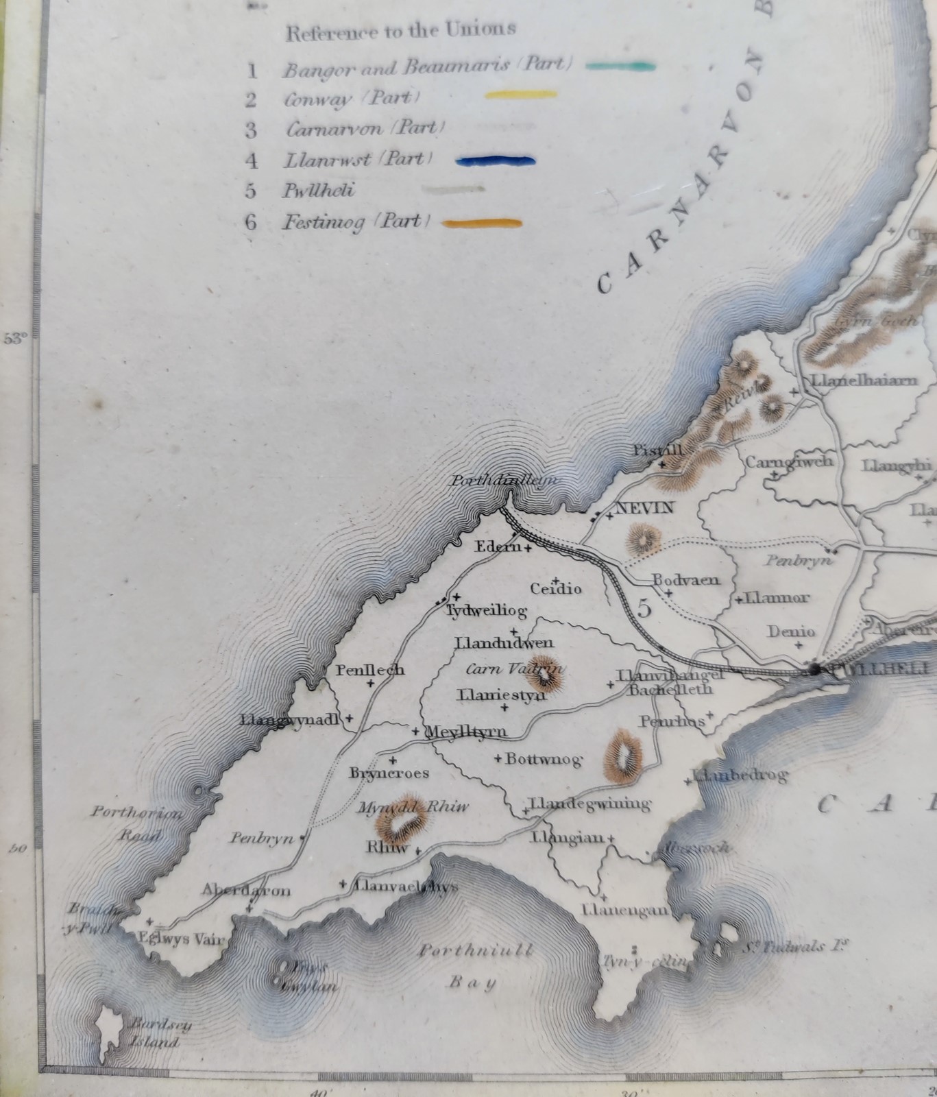
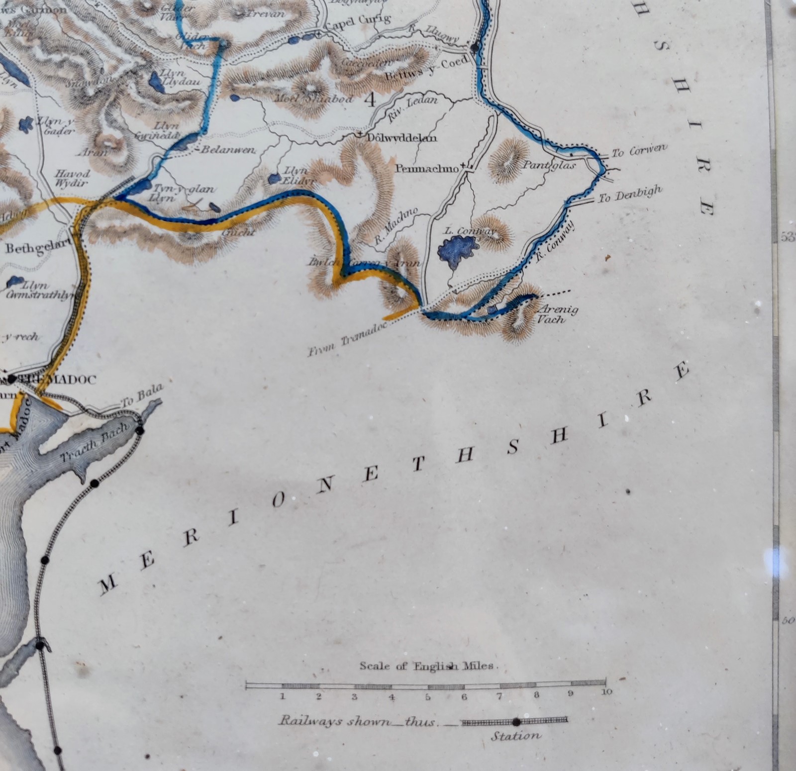
19Th Century Map Of Carnarvonshire- Sir Gaernarfon
Stock No
GSN1286RM
2017
- £60.00
- €70 Euro
- $80 US Dollar
Questions about this item?
Like this item?
Item Description
Lovely, hand coloured Steel-Engraved19th Century map of Carnarvonshire- 'SIR GAERNARFON'
It comes from the Welsh language encyclopedia- 'Hanes Y Brytaiaid A 'R Cymry', published by William Mackenzie of London and Swansea in 1872
It shows the railways which opened in 1862, (mainly closed in 1964)
In a later Hogarth frame, both in very good condition
Dimensions: Height 21.5cm, Width 27cm, Thickness 1.5cm
Shipping: Tracked and insured £8
Item Info
Seller
Seller Location
West London, London
Period
19th Century
Item Location
United Kingdom
Seller Location
West London, London
Item Location
United Kingdom
Seller Contact No
+44 (0)779 2722264
More from GENERAL STORE NO.2