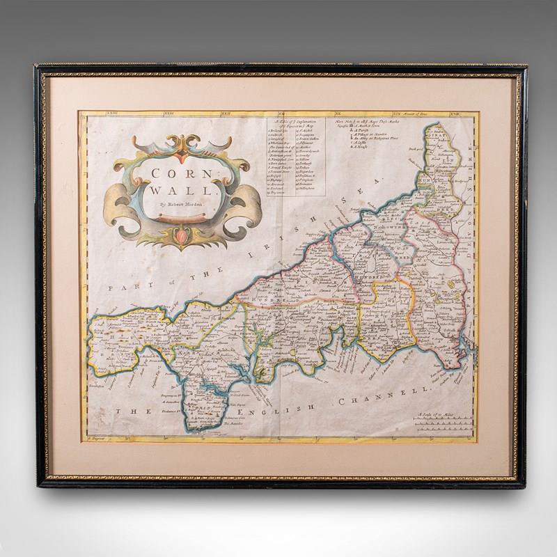
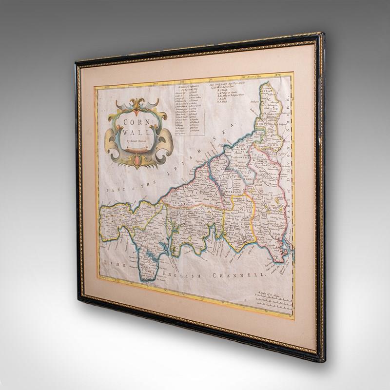

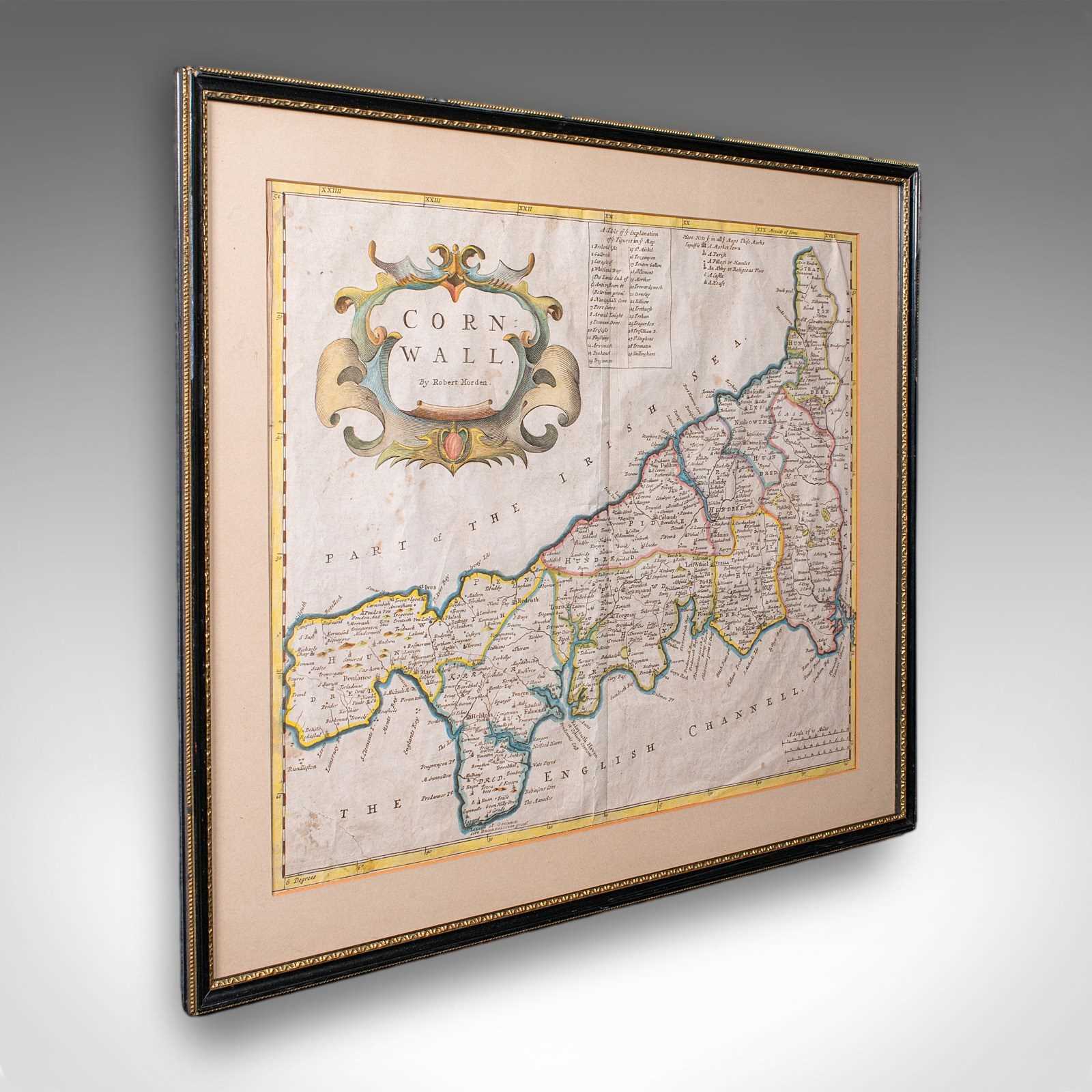
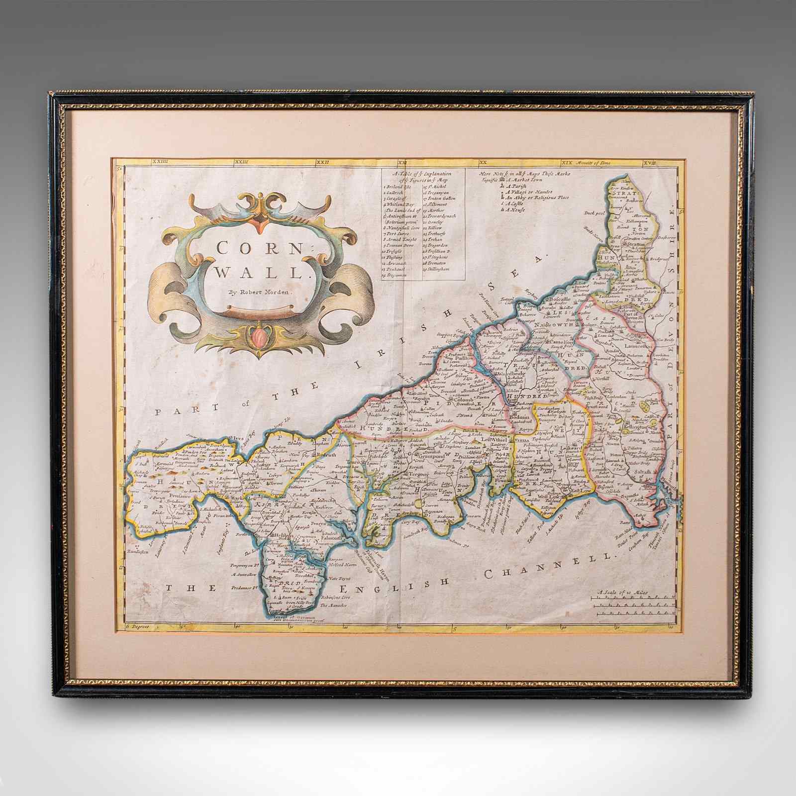
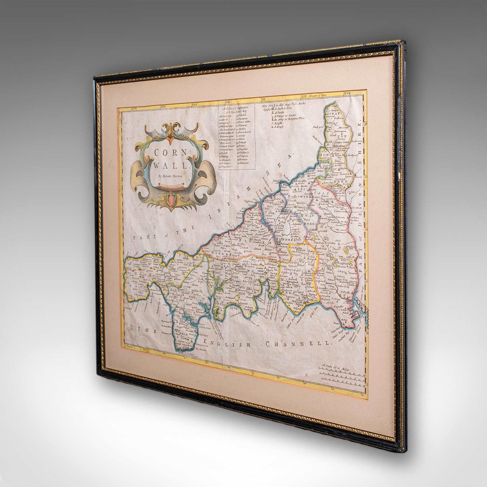
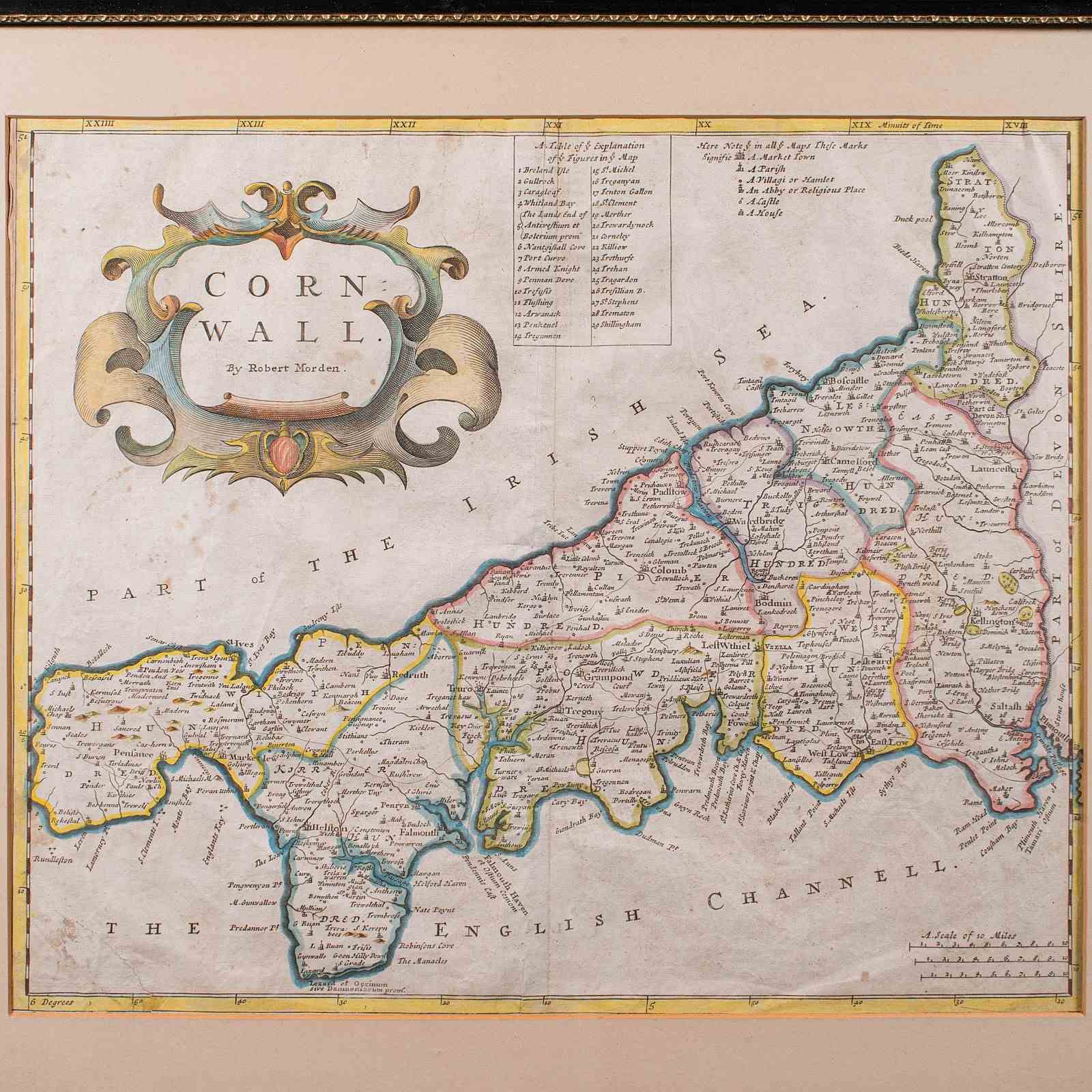


Antique Framed Cornwall Map, English, Atlas Cartography, Robert Morden, C.1700
Stock No
25926
2024
- £495.00
- €580 Euro
- $662 US Dollar
Questions about this item?
Like this item?
Item Description
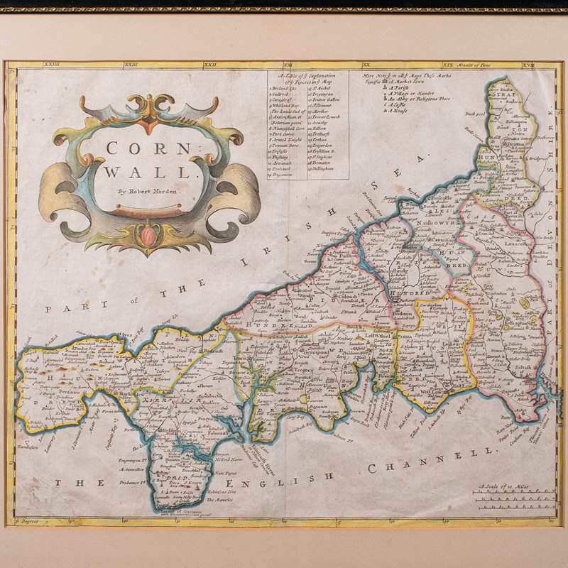
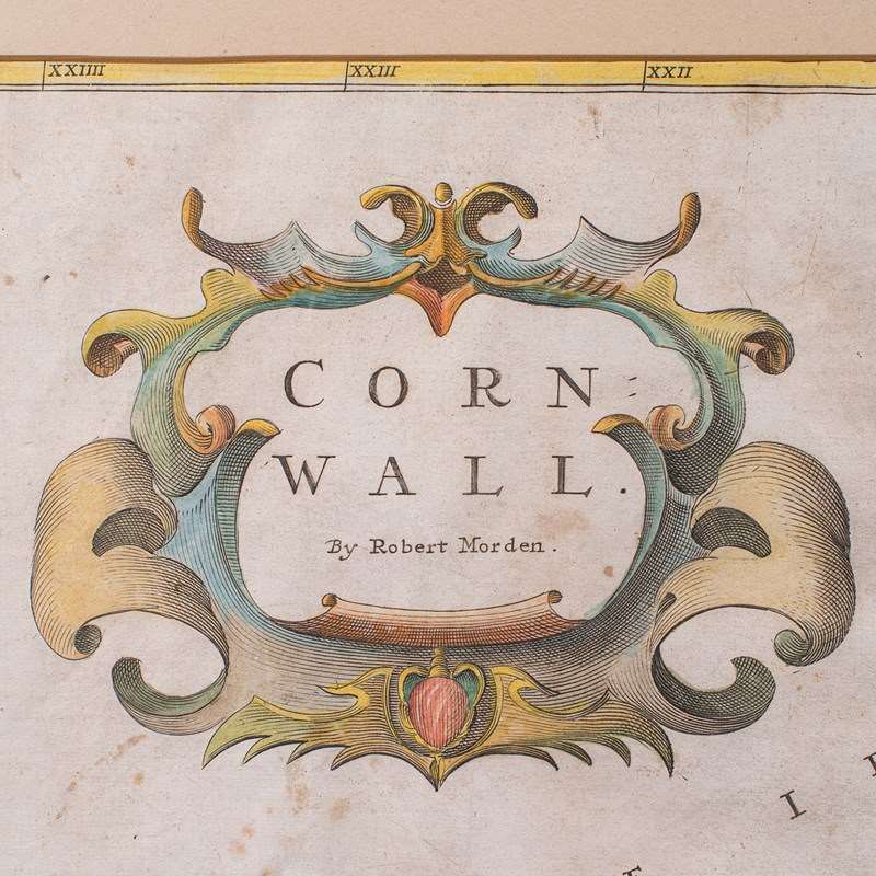
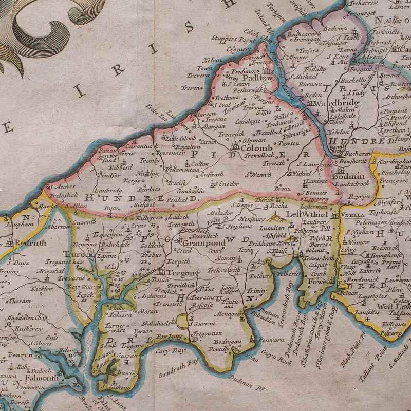
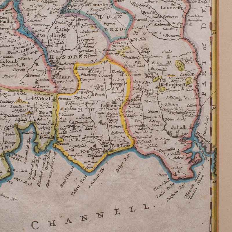
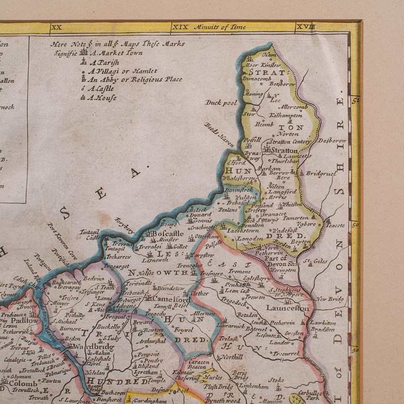
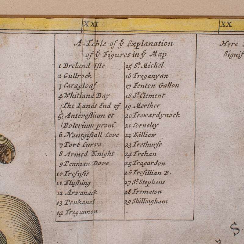
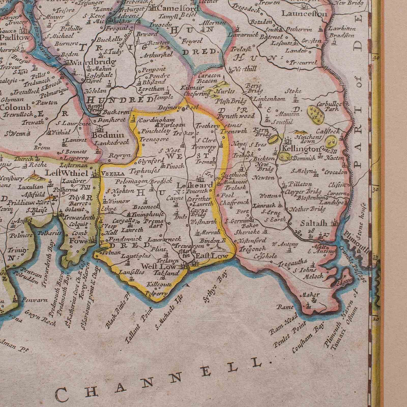
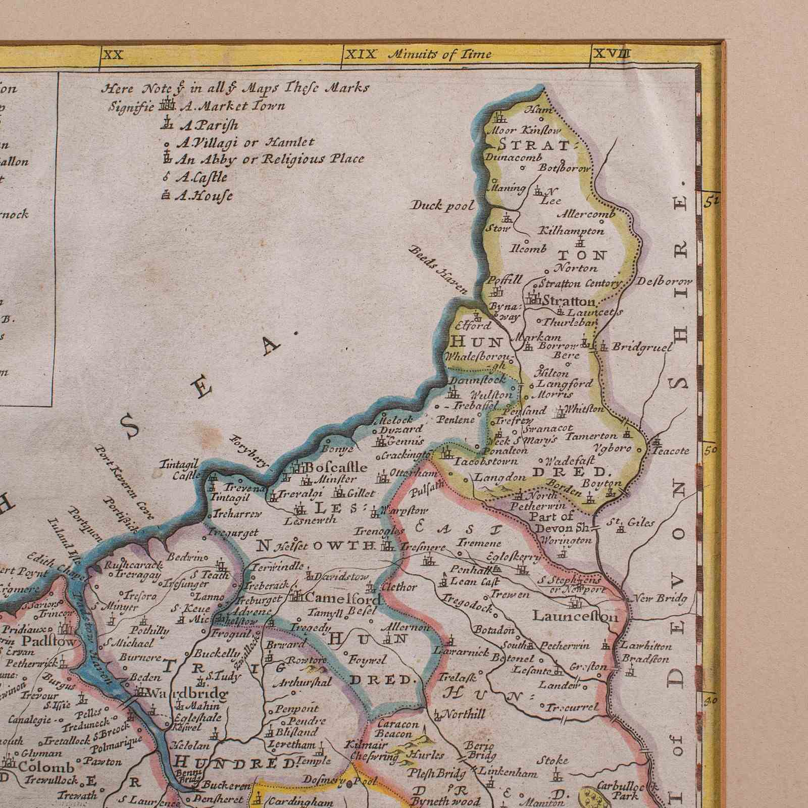
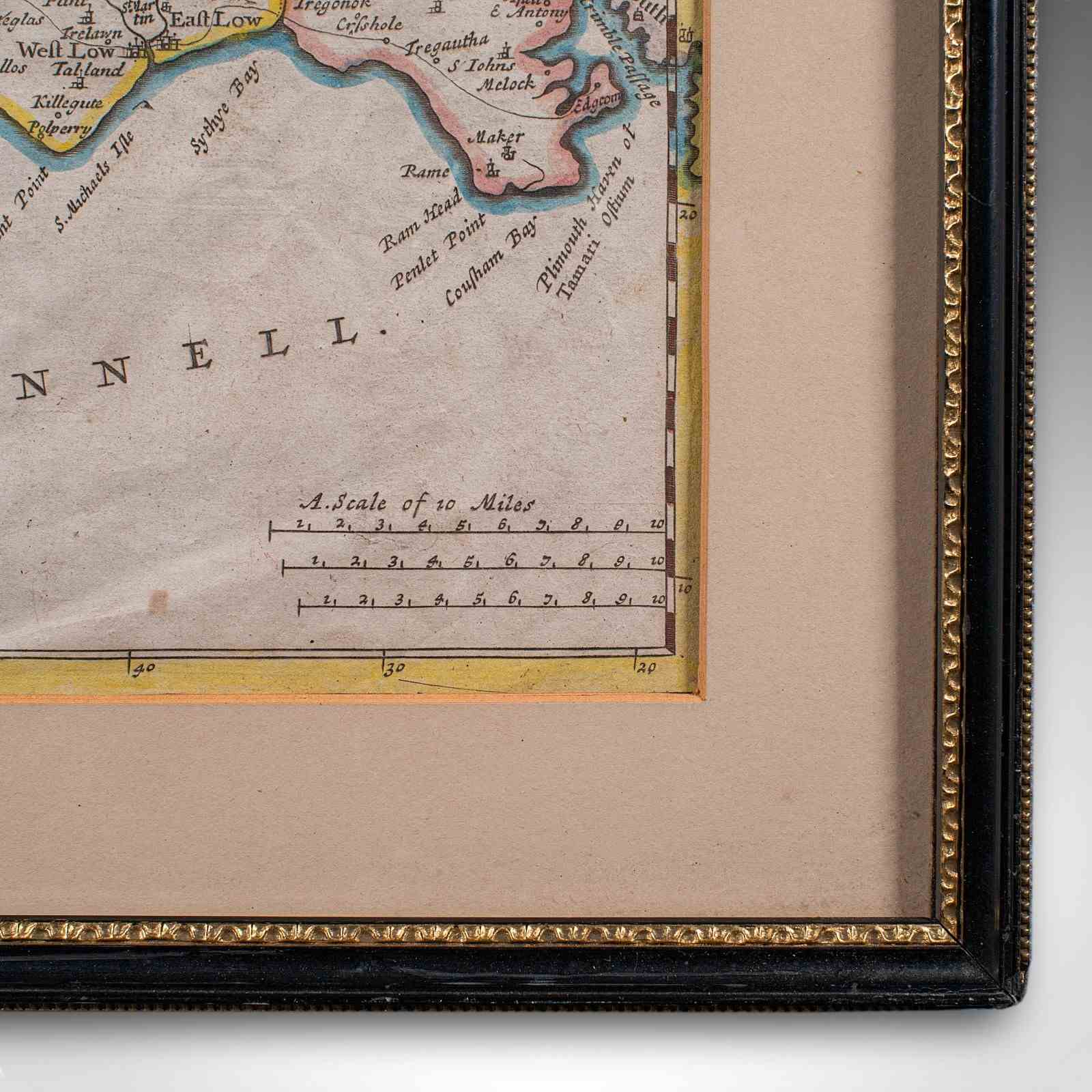
This is an antique framed map of Cornwall. An English, atlas engraving of cartographic interest By Robert Morden, dating to the late 17th century and later.
Delightful lithography of Cornwall and its county detail, perfect for display
Presenting a desirable aged patina and in good order throughout
Superb cartography, appealingly set within a quality, later frame
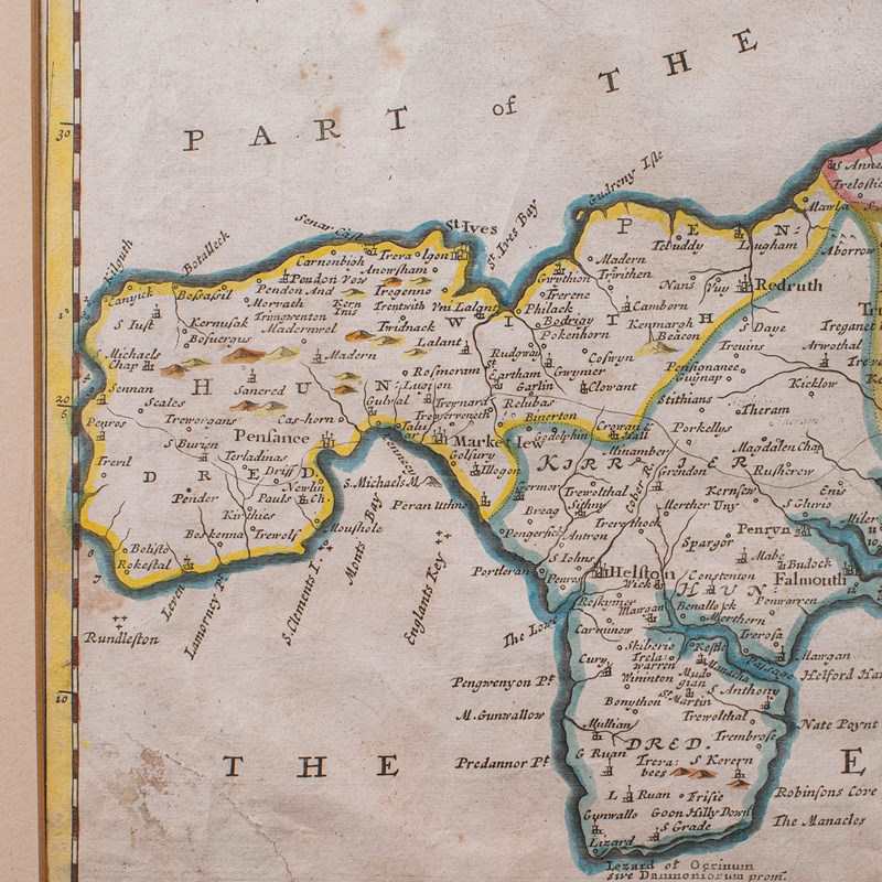
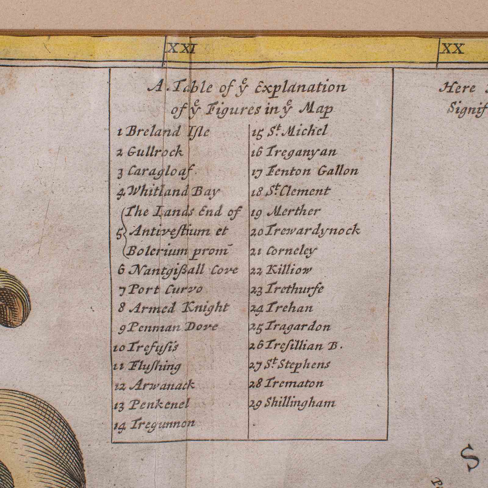
Appealing level of detail and annotation adds further collector interest
Fine historical appeal, with place names written in their 17th century form
County represented by The Hundreds, the administrative divisions within counties until the mid 19th century
Mapped by Robert Morden (1650 - 1703) in high detail and hand coloured for visual appeal
Dressed to the rear with hanging wire for ease of mounting
This is a charming antique map of Cornwall, with fine cartographic interest and presented in a tasteful later frame. Delivered ready to display.
Dimensions:
Max Width: 53cm (20.75'')
Max Depth: 1.5cm (.5'')
Max Height: 46cm (18'')
Map Width: 43cm (17'')
Map Height: 36cm (14.25'')
Item Info
Seller
Seller Location
Hele, Devon
Item Dimensions
H: 46cm W: 53cm D: 1.5cm
Period
1700s
Item Location
United Kingdom
Seller Location
Hele, Devon
Item Location
United Kingdom
Seller Contact No
+44 (0)207 1833511
More from LONDON FINE ANTIQUES