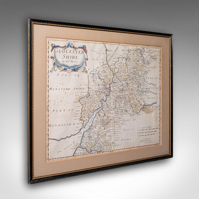
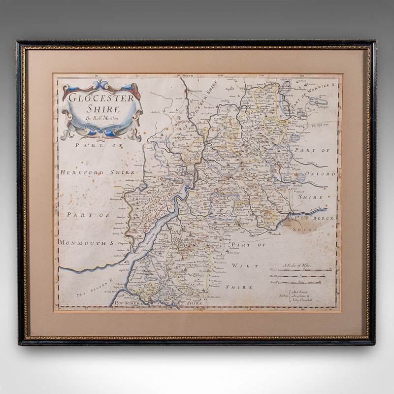
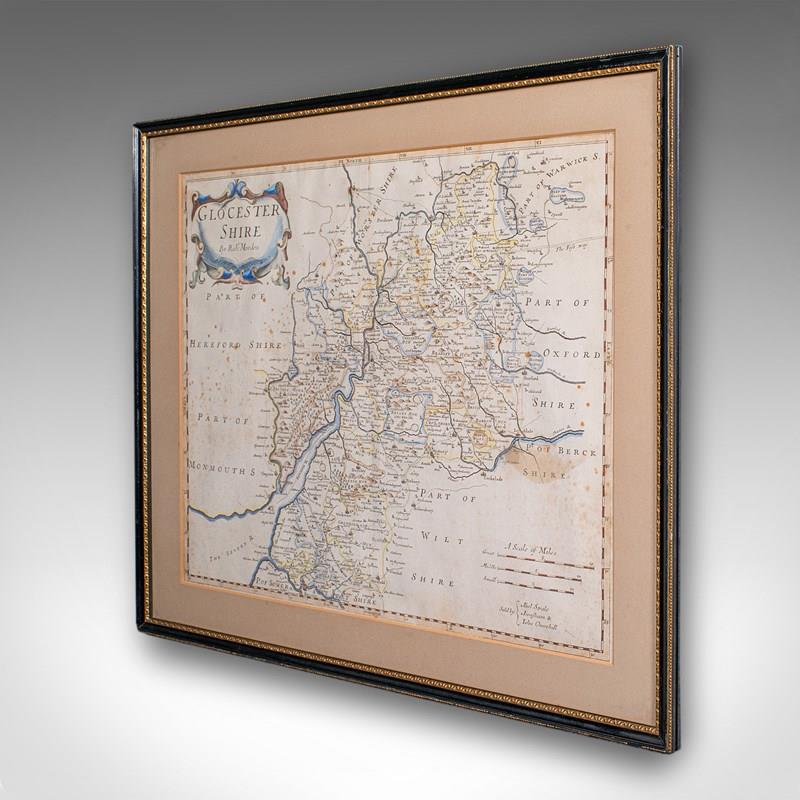
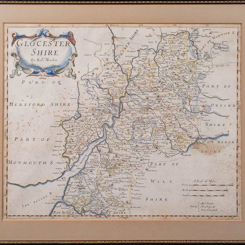
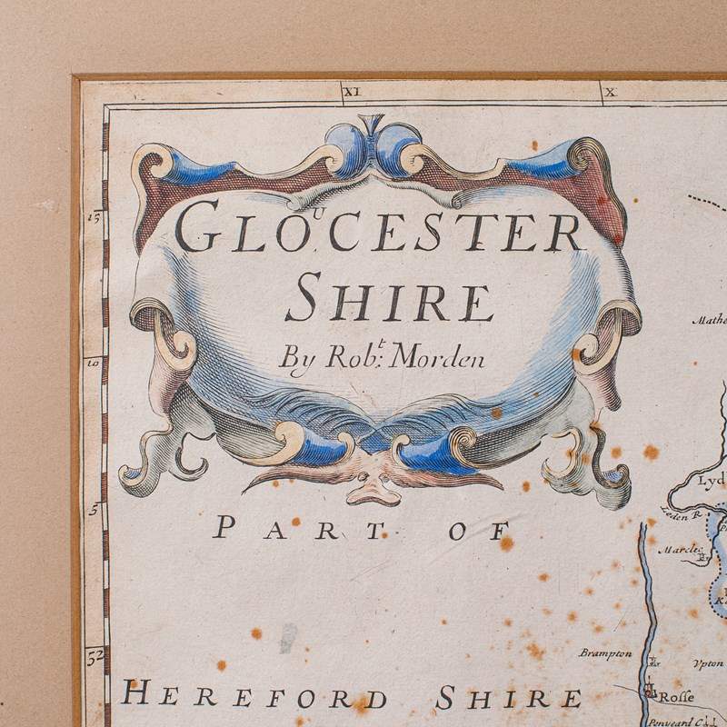
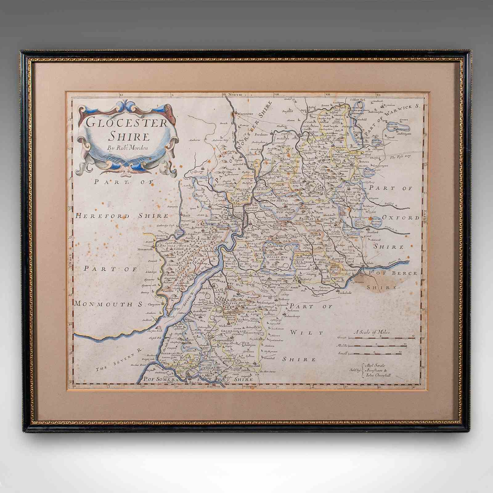
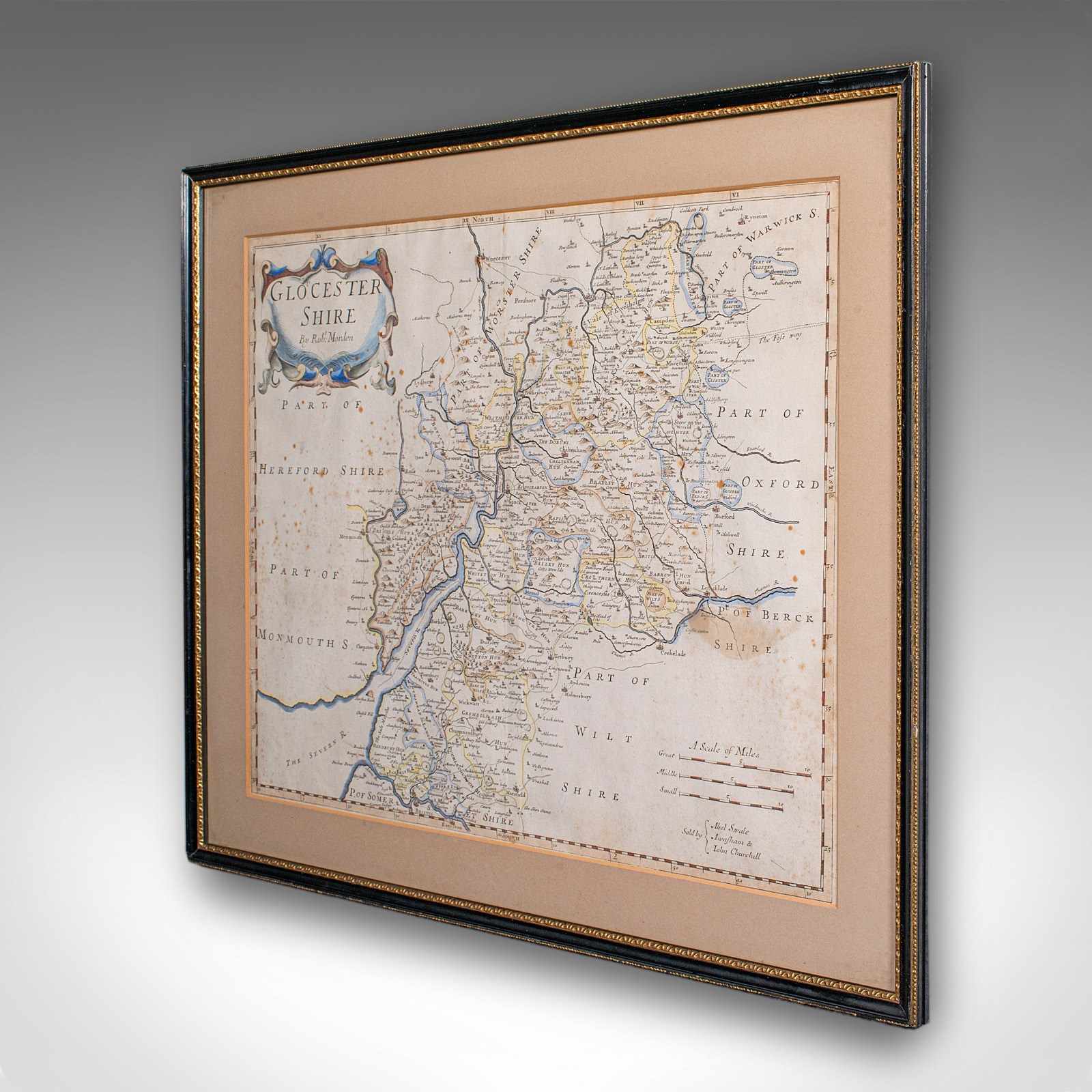
Antique Framed Gloucestershire Map, English Atlas Engraving, Cartography, C.1700
Stock No
25924
2024
- £695.00
- €814 Euro
- $929 US Dollar
Questions about this item?
Like this item?
Item Description
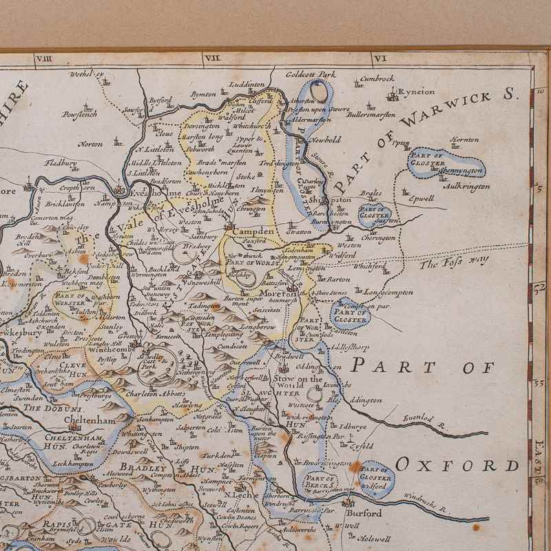
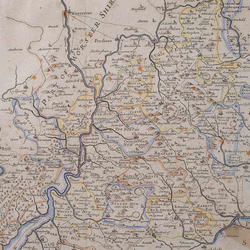
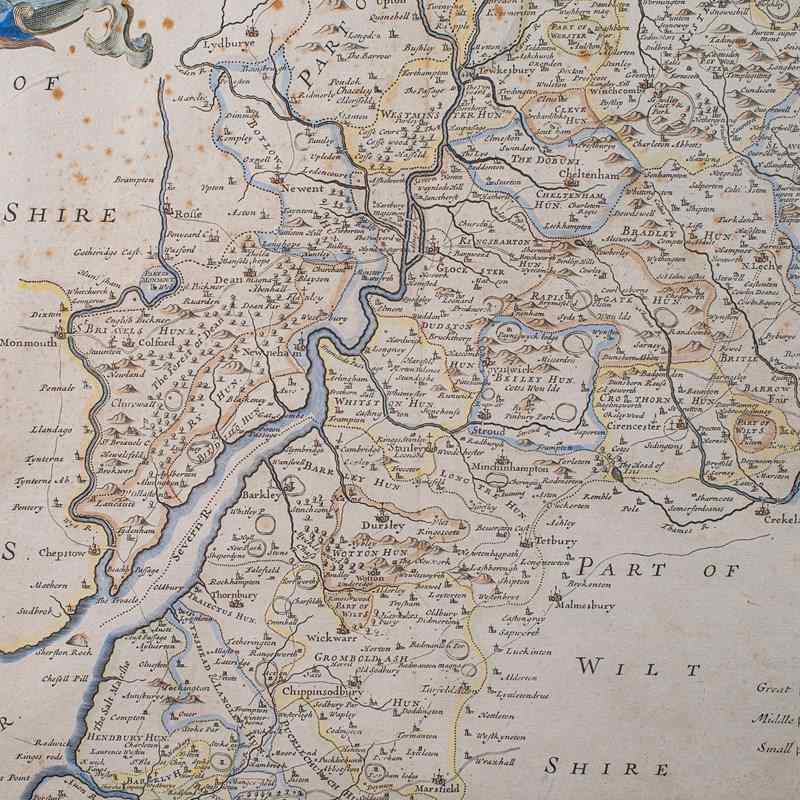
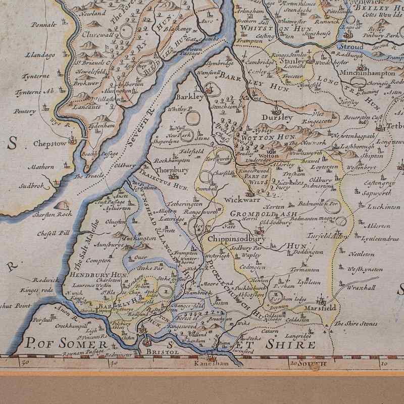
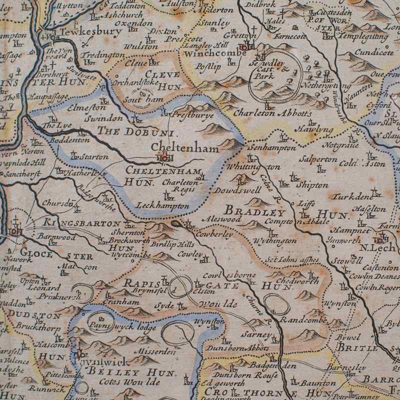
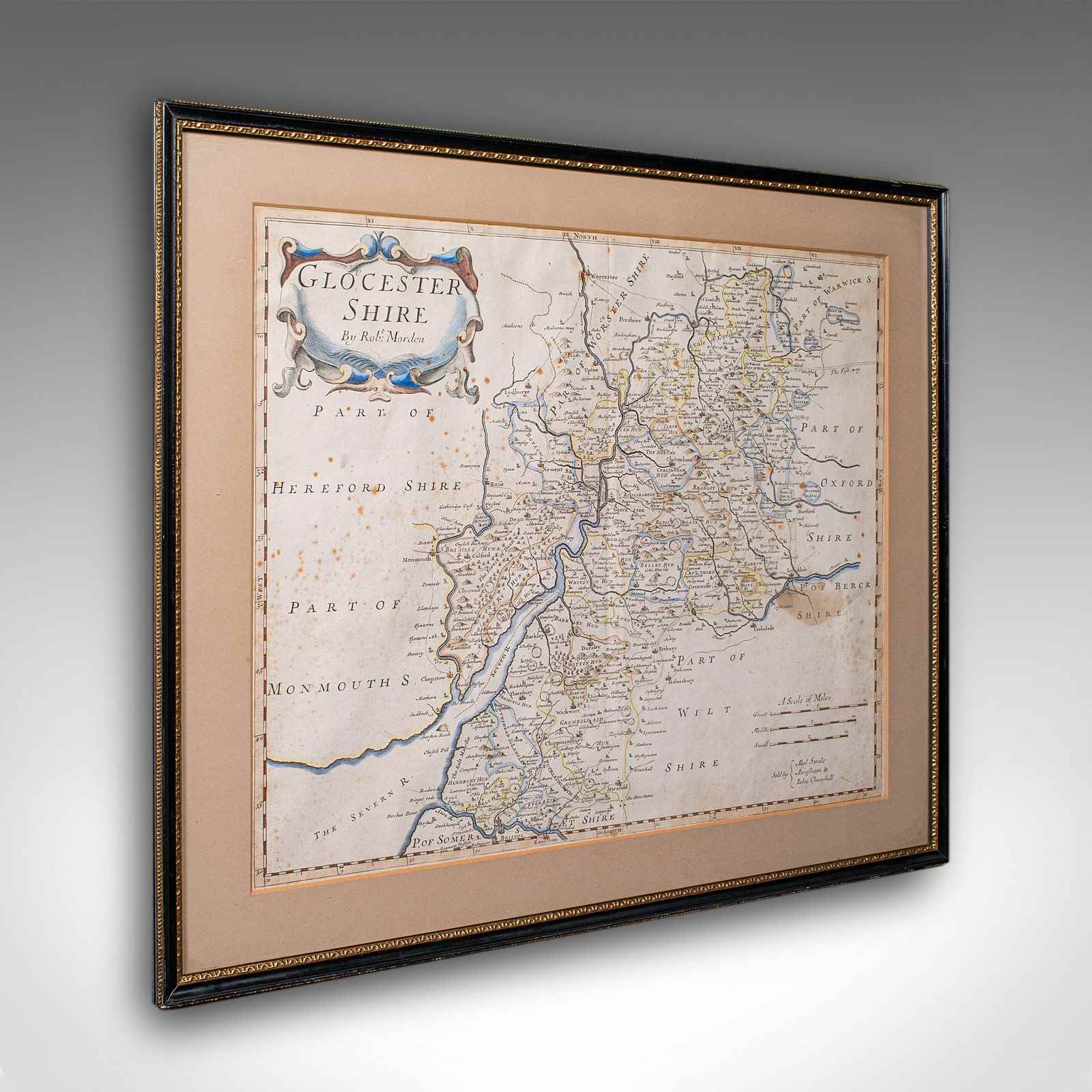
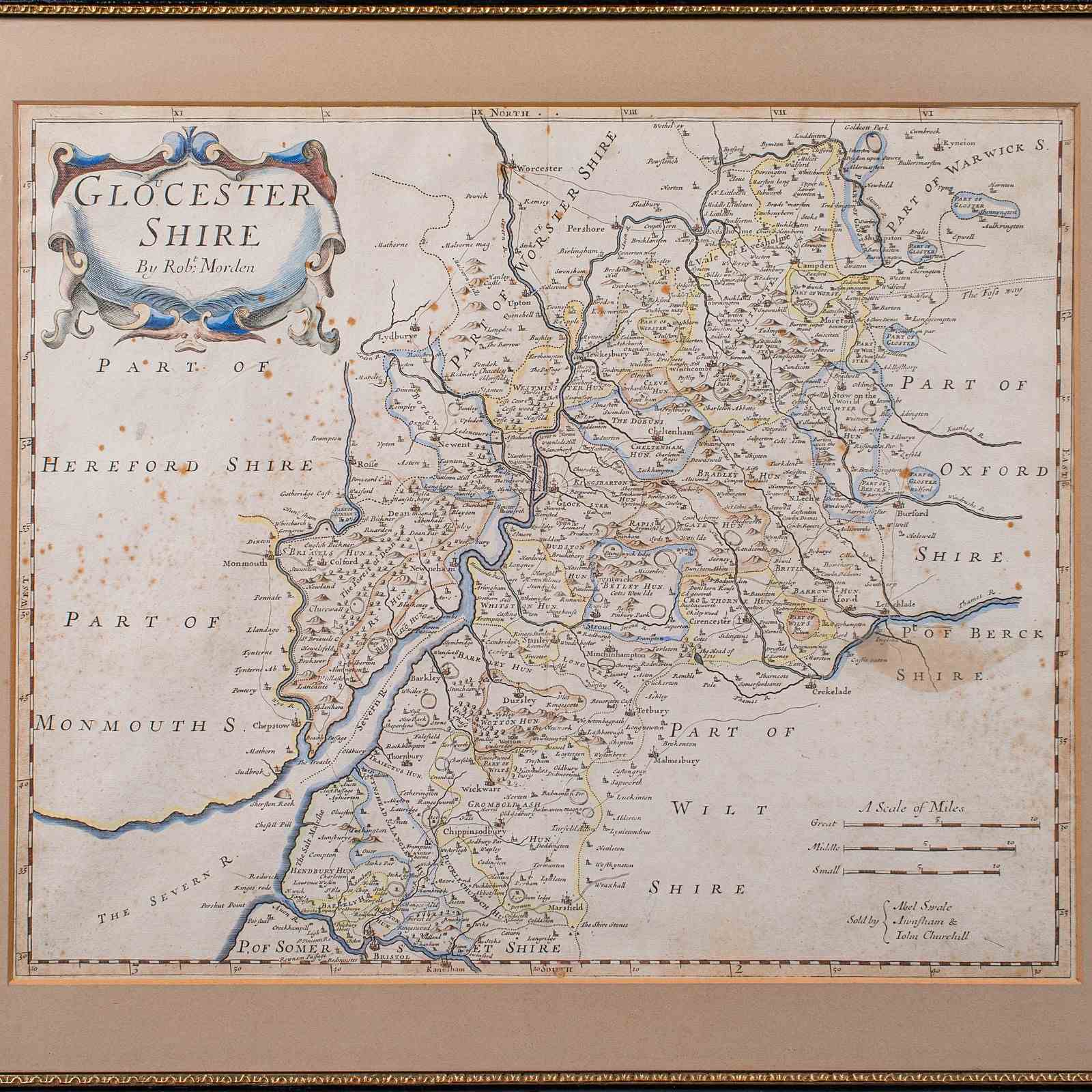
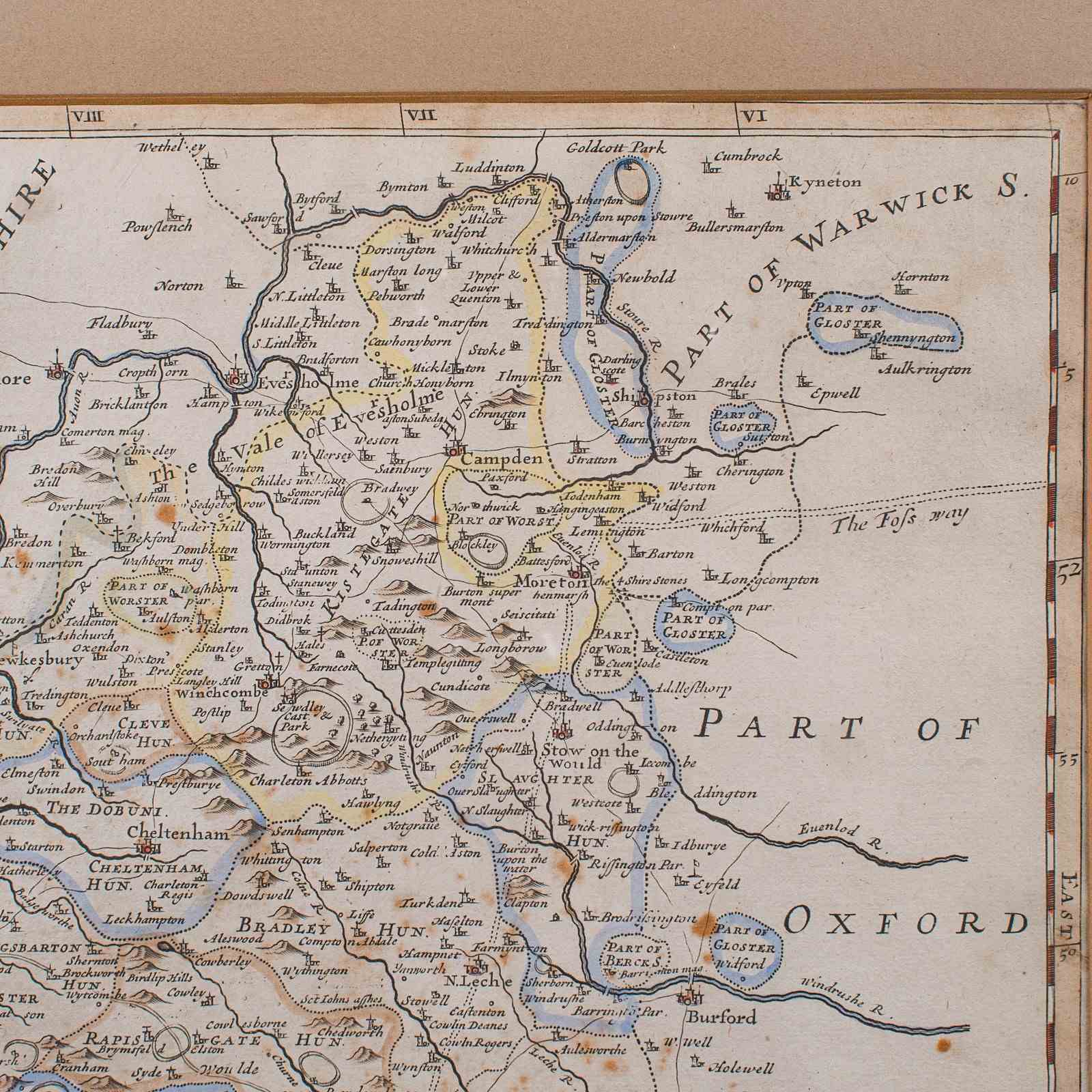
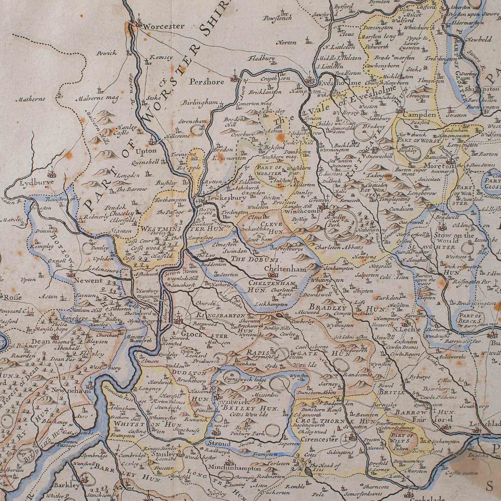
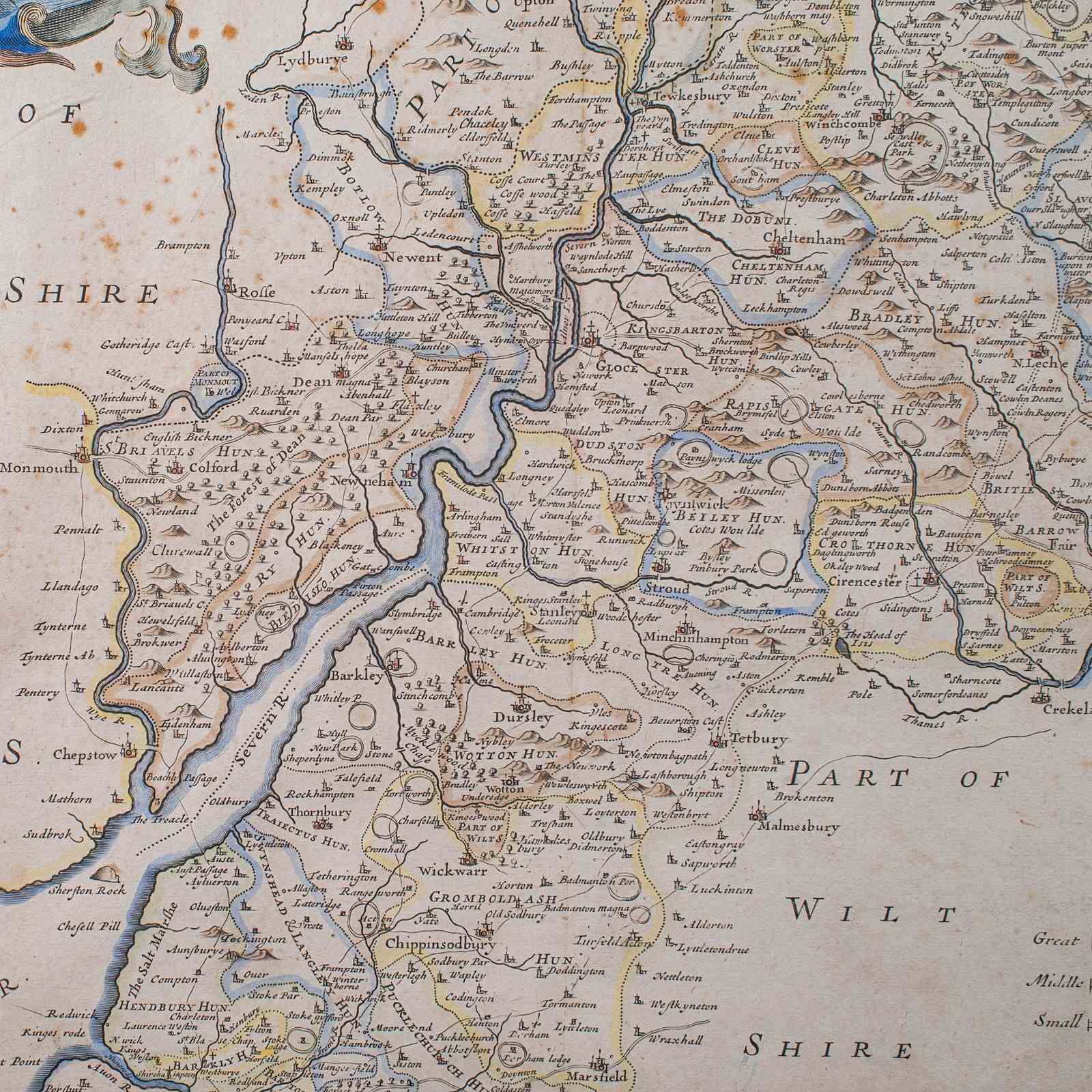
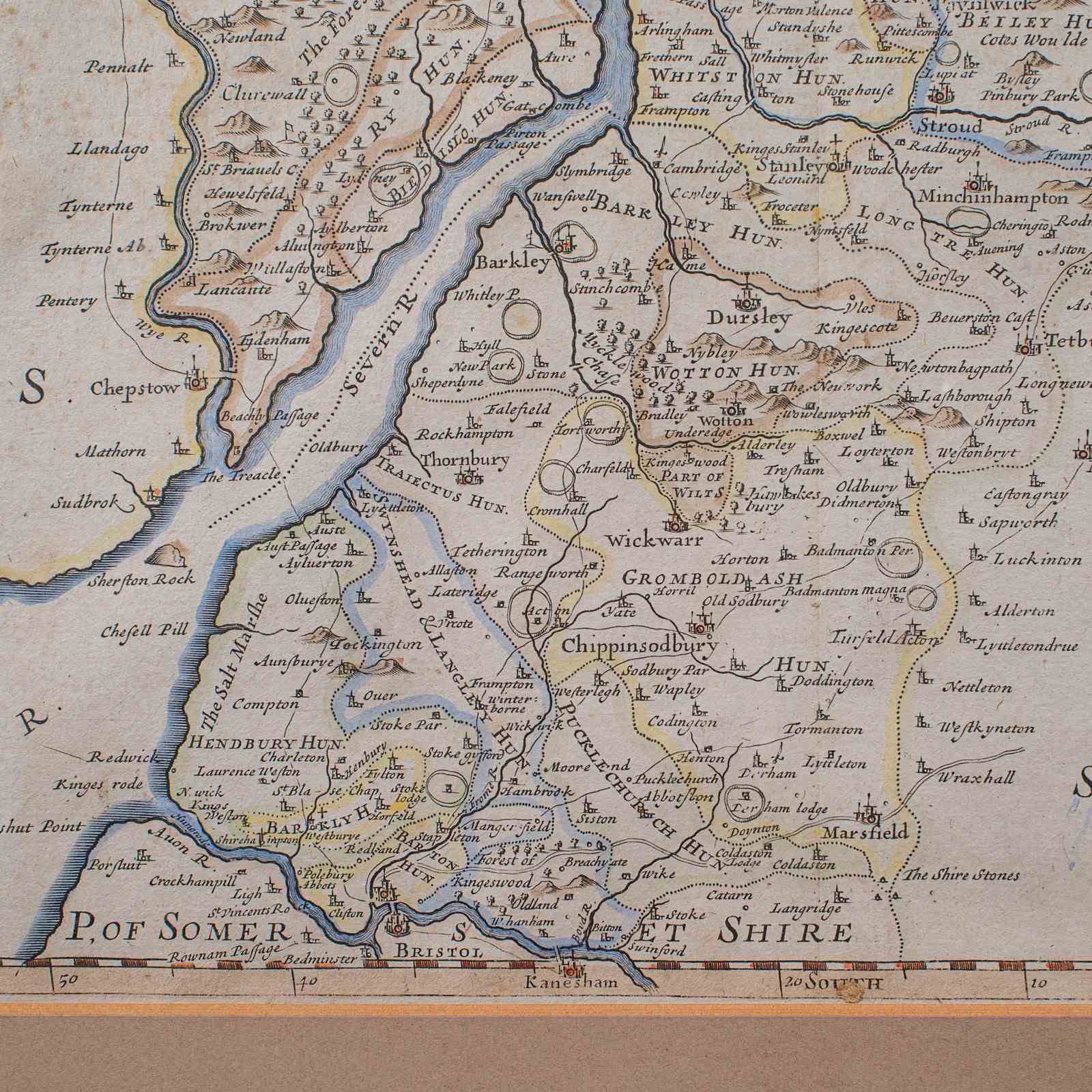
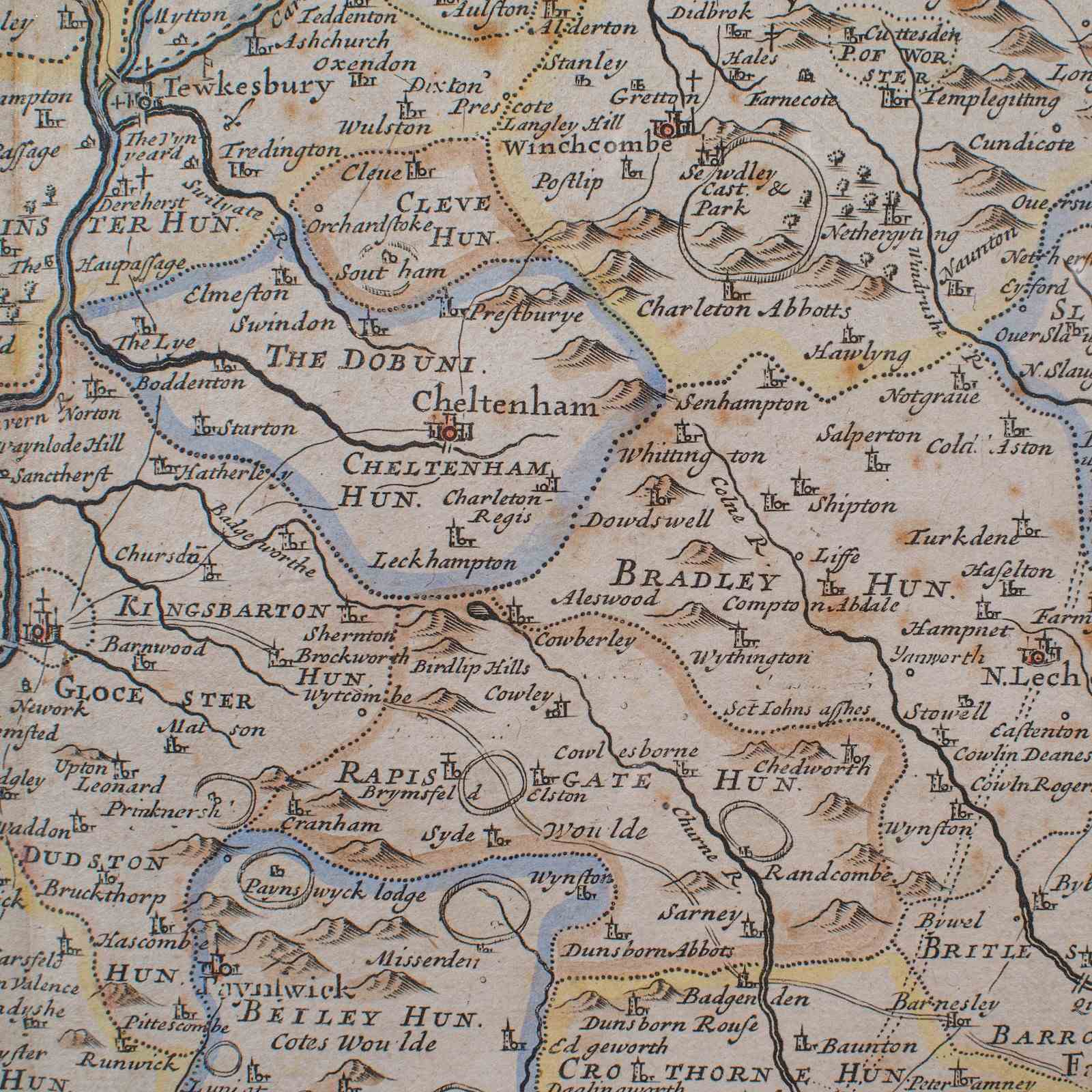
This is an antique framed map of Gloucestershire. An English, atlas engraving of cartographic interest By Robert Morden, dating to the late 17th century and later.
Superb atlas lithography of Gloucestershire and its county detail as it stood circa 1700
Displays a desirable aged patina, with a lightly aged finish throughout
Fascinating cartography, appealingly set within a later gilt and ebonised frame
Hand-coloured presentation, and rich in town, village and administrative detail
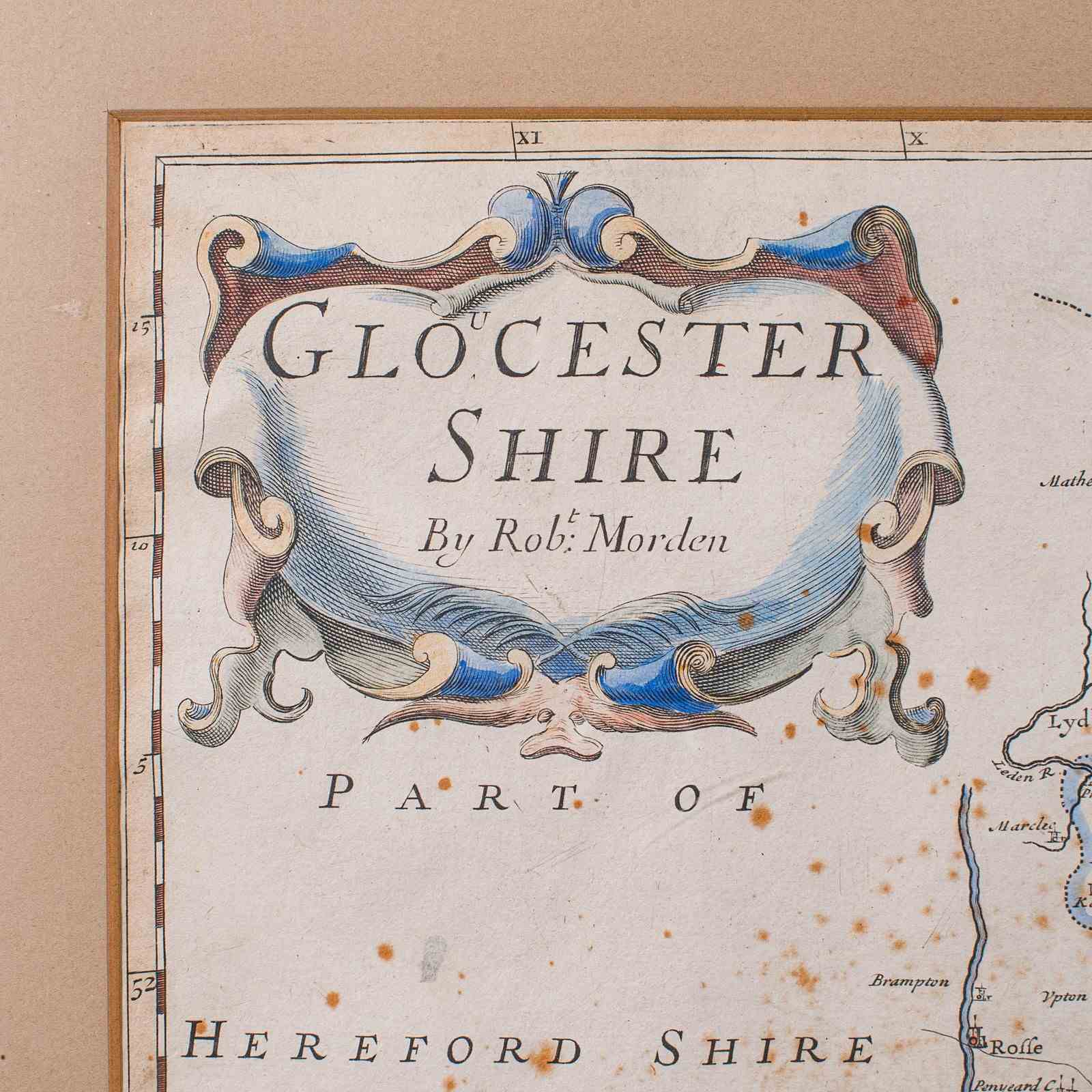
Charming, period naming for the county of Glocester Shire and locations within the county
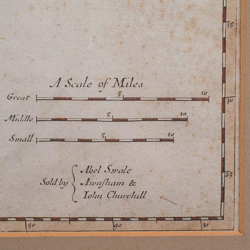
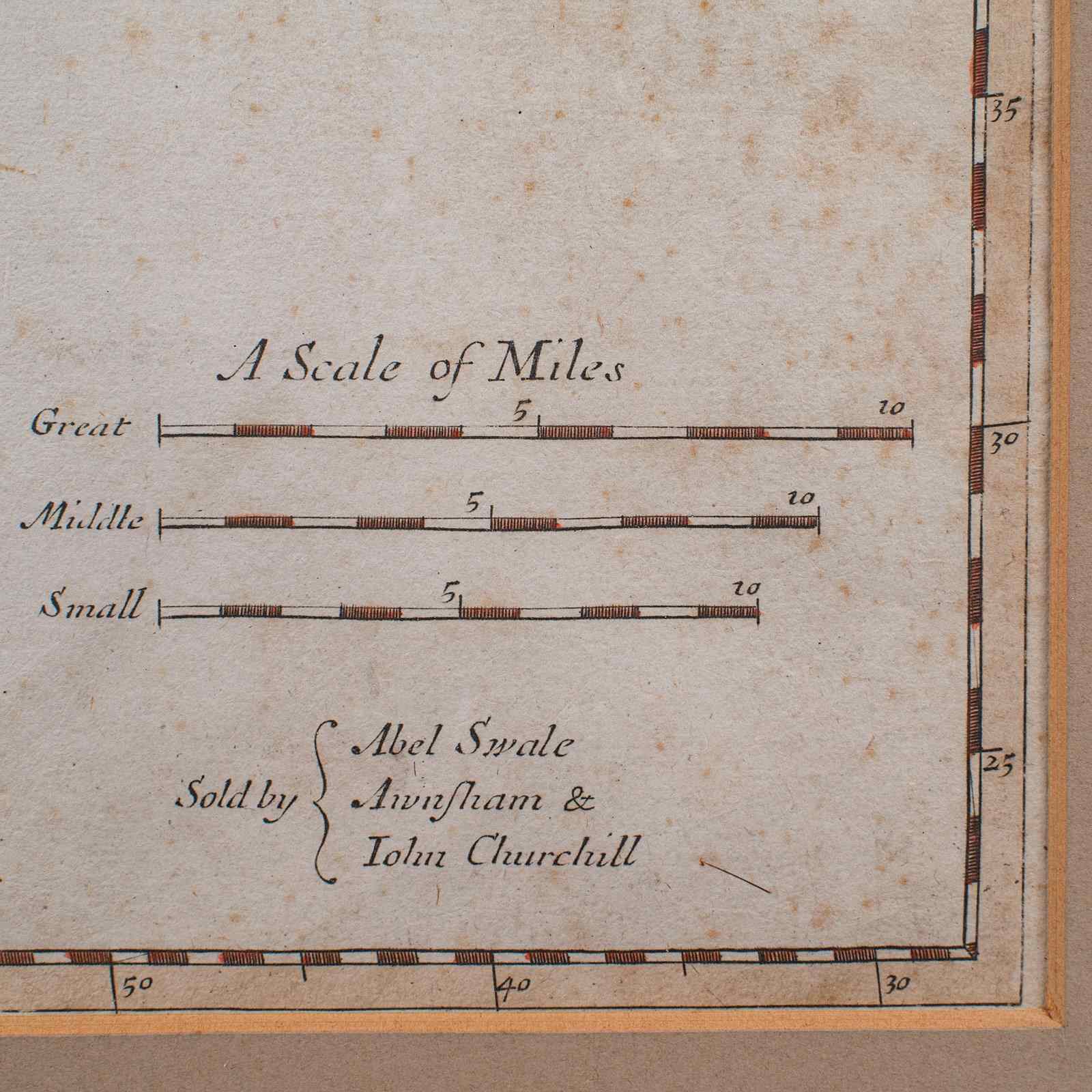
Mapped by Robert Morden (1650 - 1703) in high detail and sold by Abel Swale & John Churchill
Scale of Great, Middle and Small miles - a fascinating system devised before the standardised mile
Dressed to the rear with hanging wire for ease of mounting
This is a delightful antique map of Gloucestershire, with fine cartographic interest to the county, by a renowned map maker. A treat for display or a collector. Delivered ready to mount.
Dimensions:
Max Width: 52cm (20.5'')
Max Depth: 1.5cm (.5'')
Max Height: 44.5cm (17.5'')
Map Width: 42cm (16.5'')
Map Height: 34.5cm (13.5'')
Item Info
Seller
Seller Location
Hele, Devon
Item Dimensions
H: 44.5cm W: 52cm D: 1.5cm
Period
1700s
Item Location
United Kingdom
Seller Location
Hele, Devon
Item Location
United Kingdom
Seller Contact No
+44 (0)207 1833511