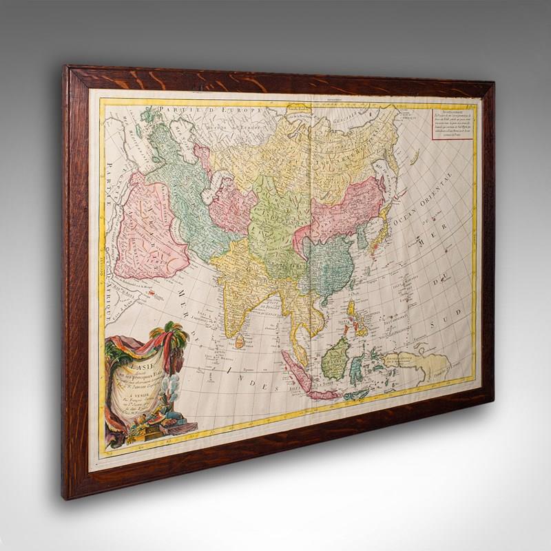
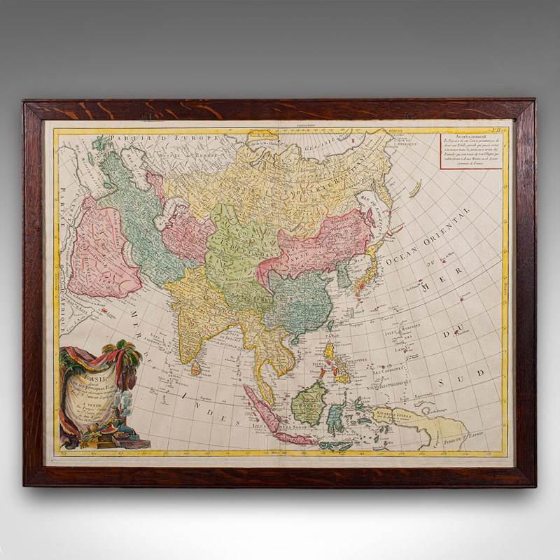


Antique Map Of Asia, French, Framed, Atlas, Continental Cartography, Georgian
Stock No
25853
2024
- £795.00
- €929 Euro
- $1,060 US Dollar
Questions about this item?
Like this item?
Item Description
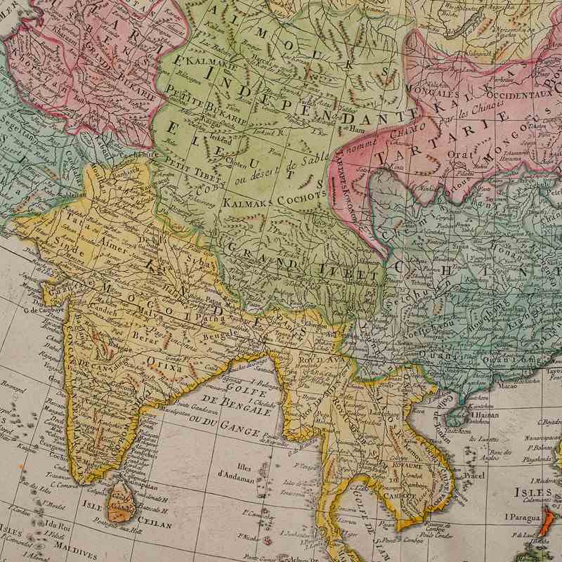
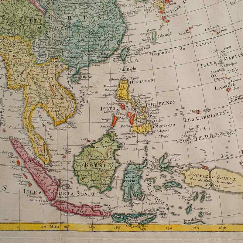
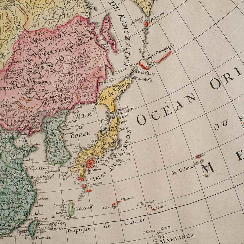
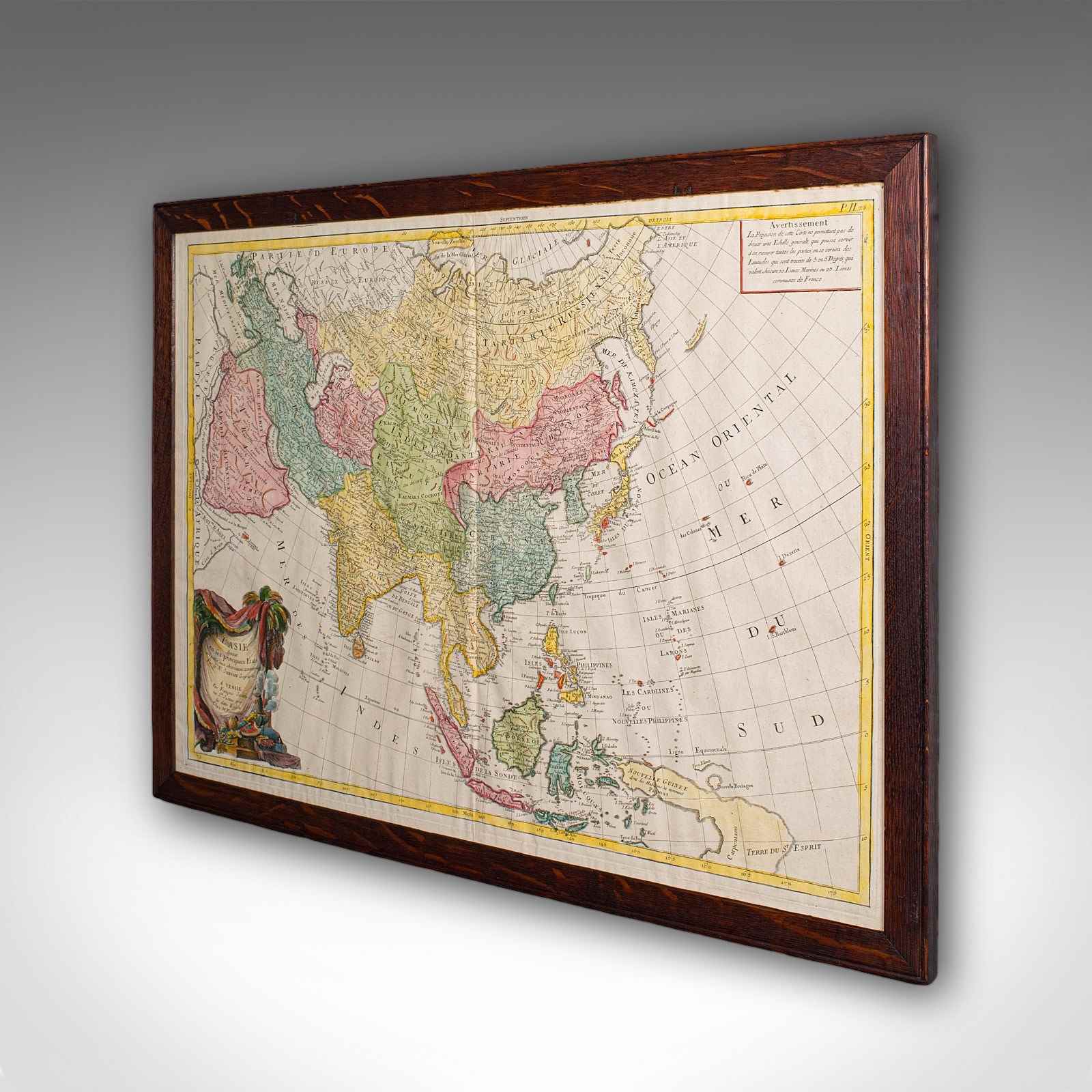
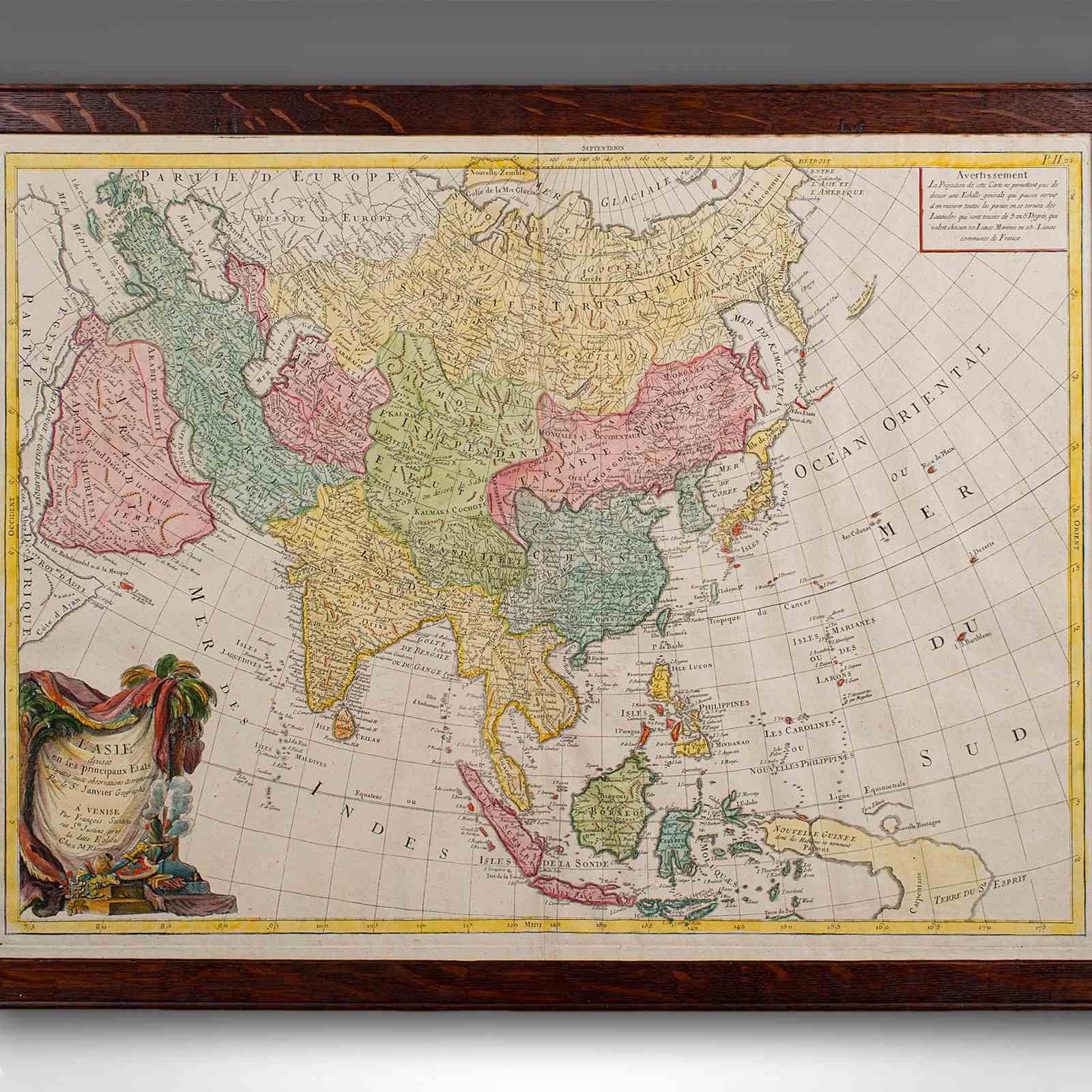
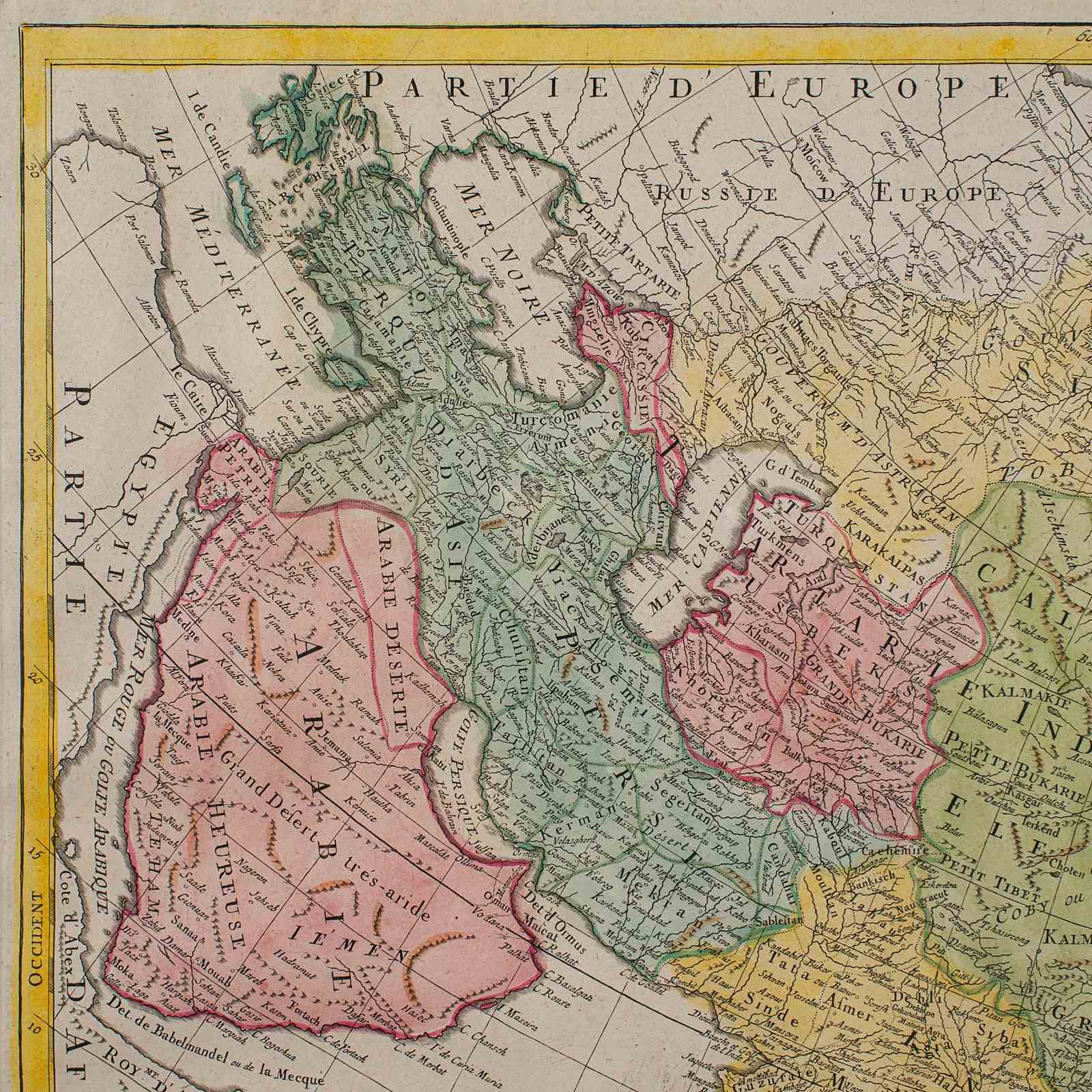
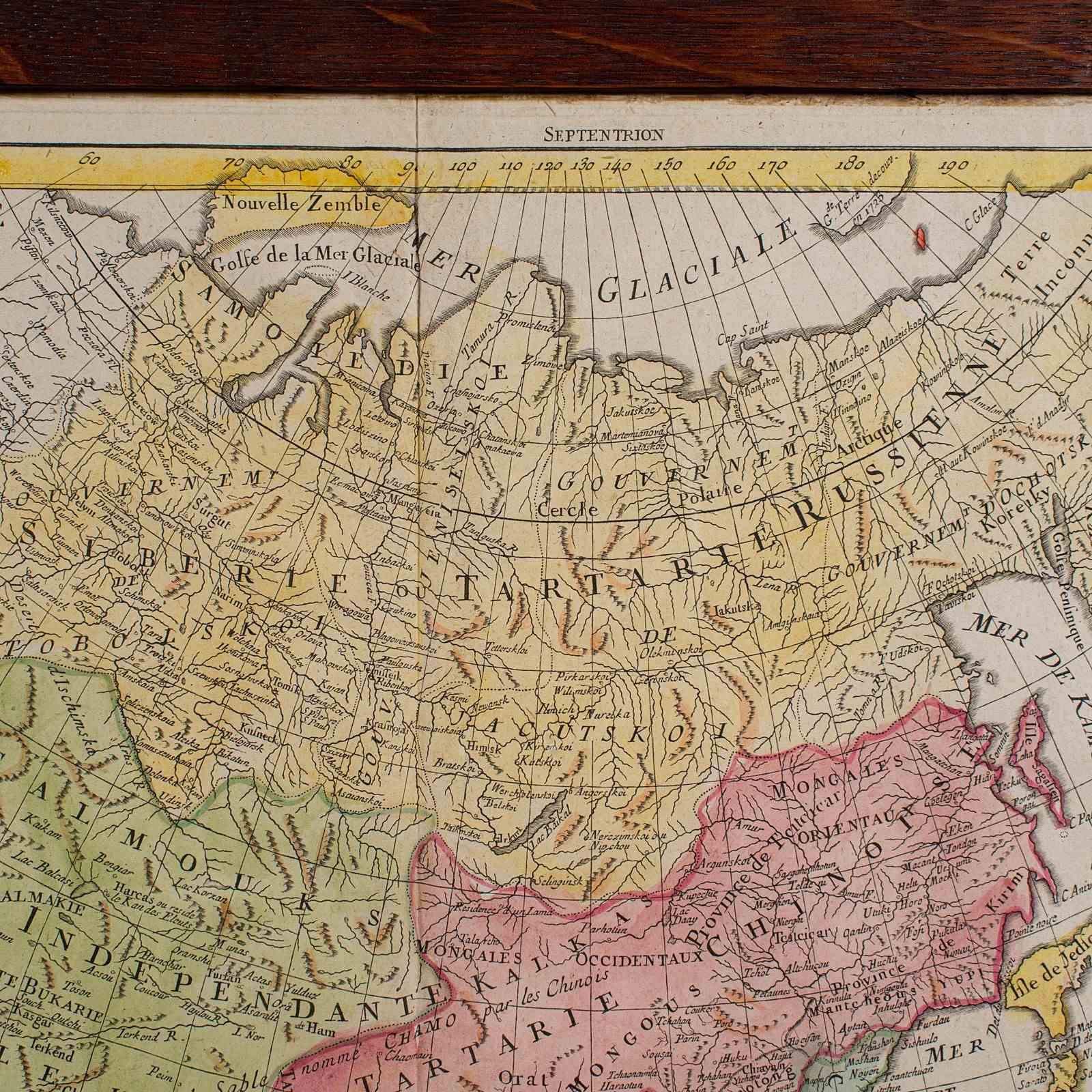
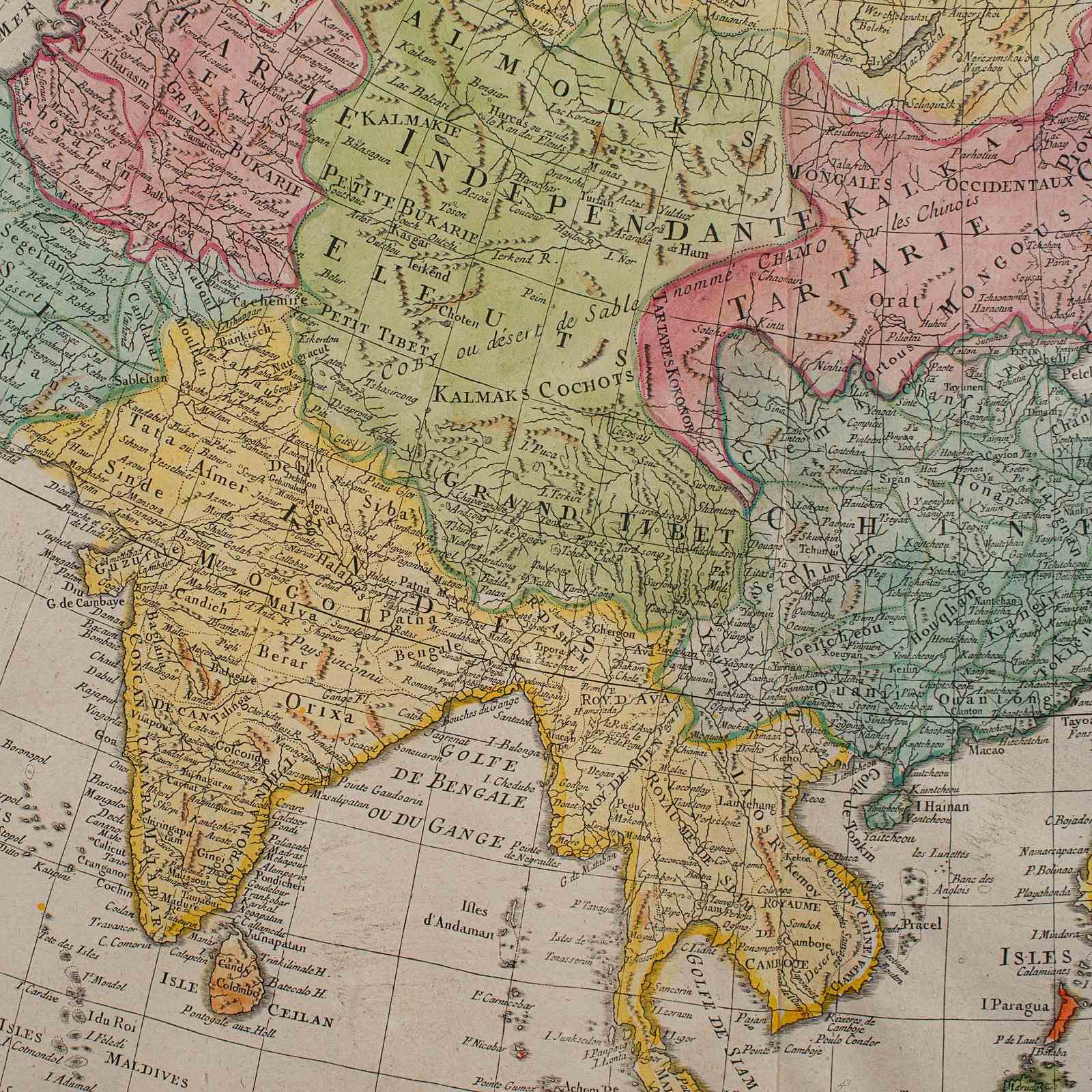
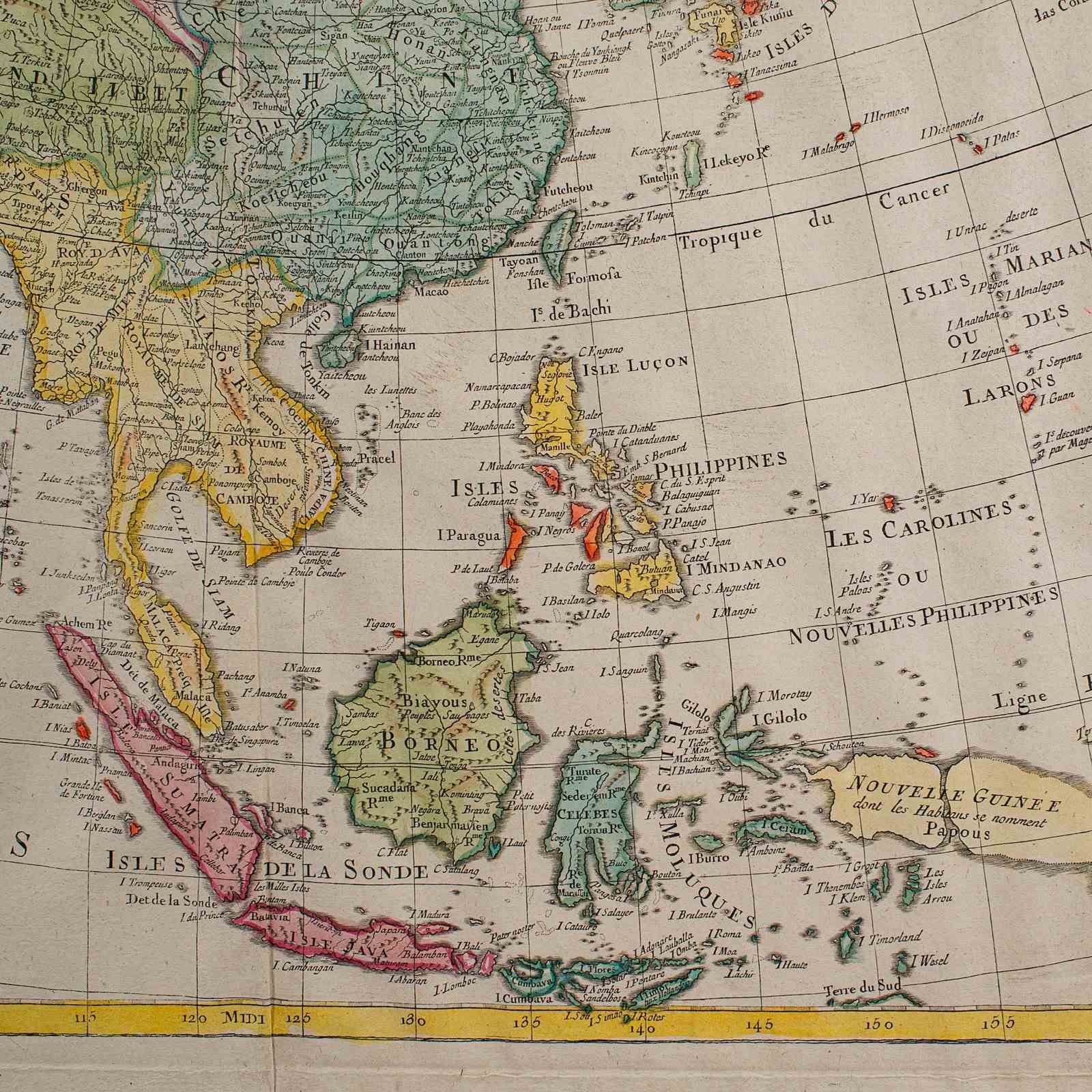
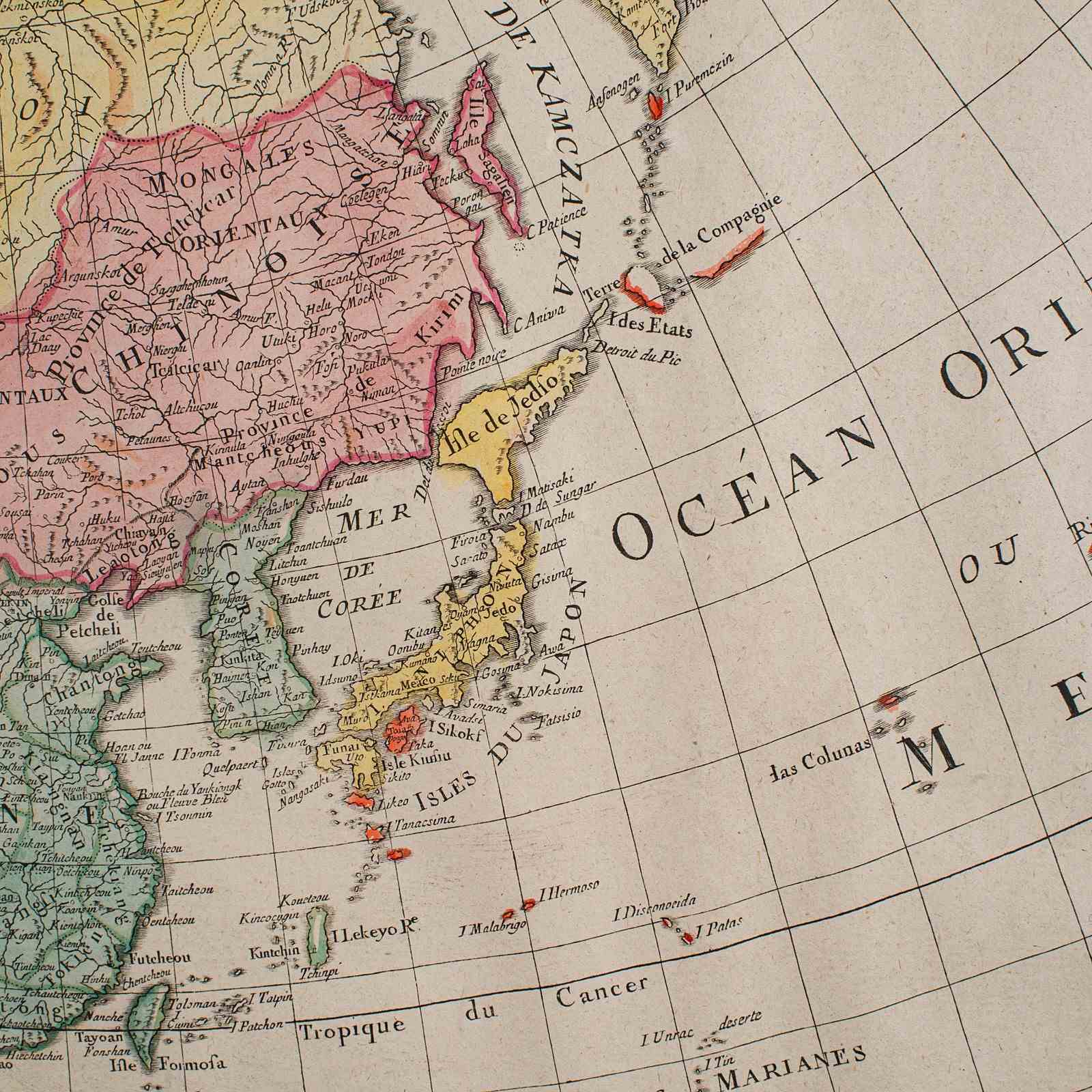
This is an antique map of Asia. A French, framed atlas representation of the continent, dating to the late 18th century, circa 1800.
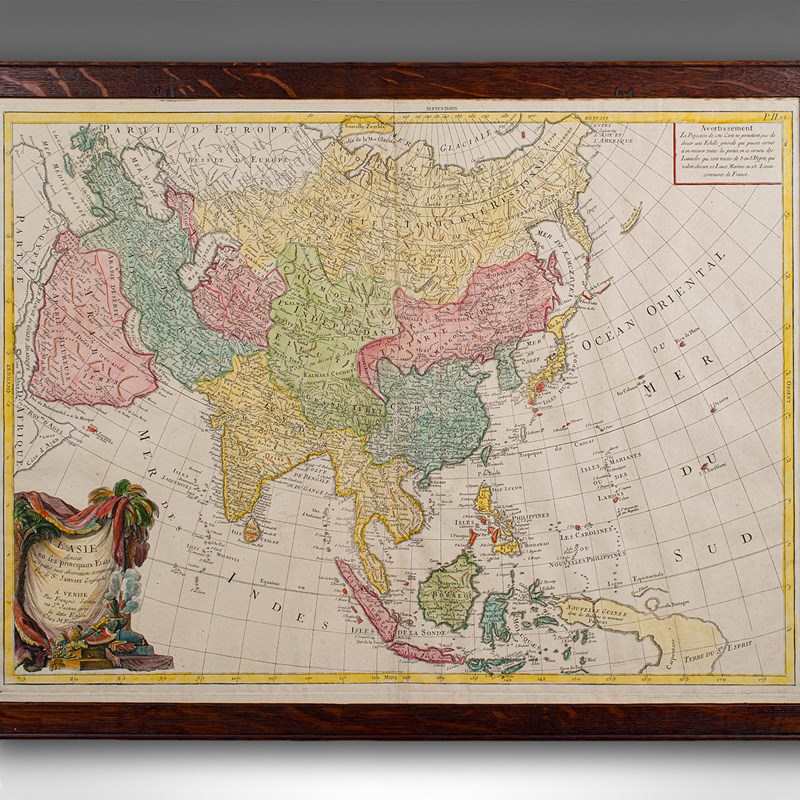
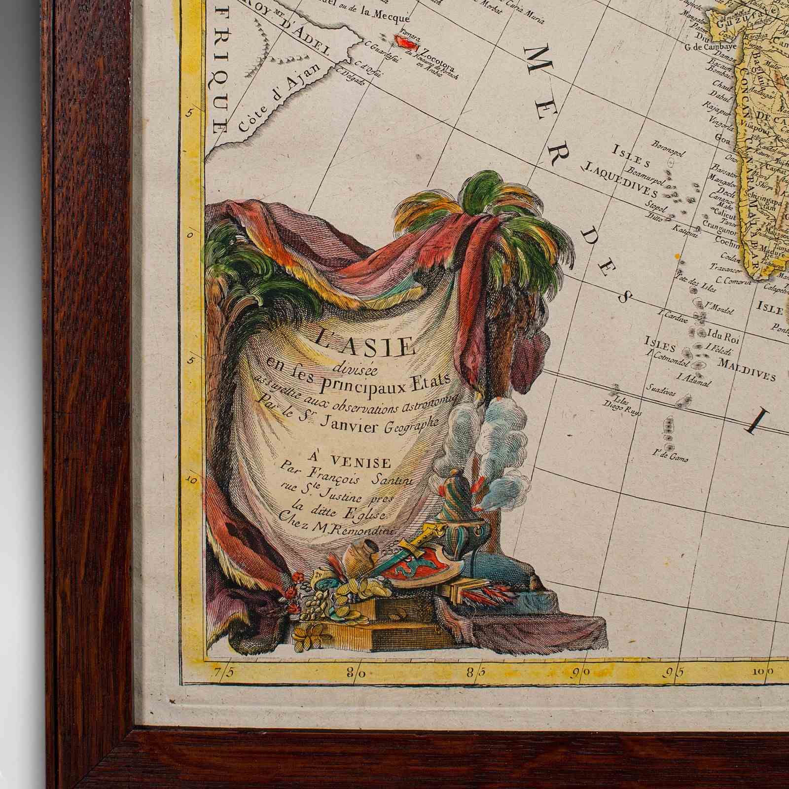
A fine framed excerpt, originaly published in the Atlas Moderne ou Collection de Cartes sur Toutes les Parties du Globe Terrestre, circa 1780. Compiled and engraved by Jean Denis Javier and Jean Lattré respectively.
Fascinating cartographic interest of the Asian continent in the 18th century
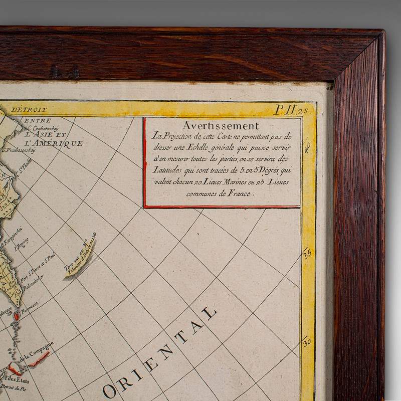
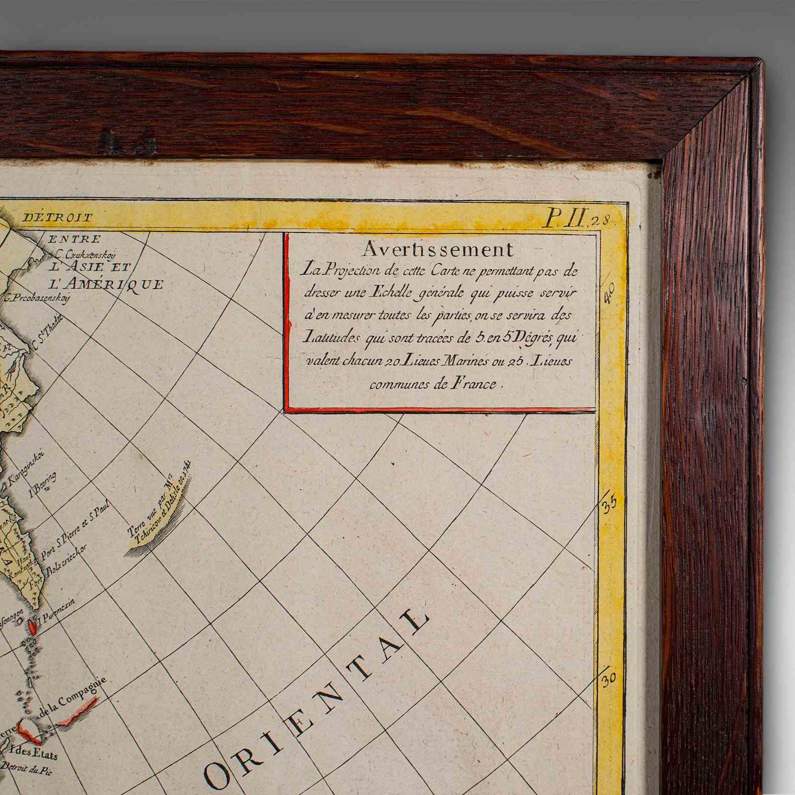
Displays a desirable aged patina and in good order
Set within a quality later frame, with fine grain interest and clear, bright glass
Dressed to the rear with hanging wire for ease of mounting
Represents an Asia-centric projection of the continent in full colour
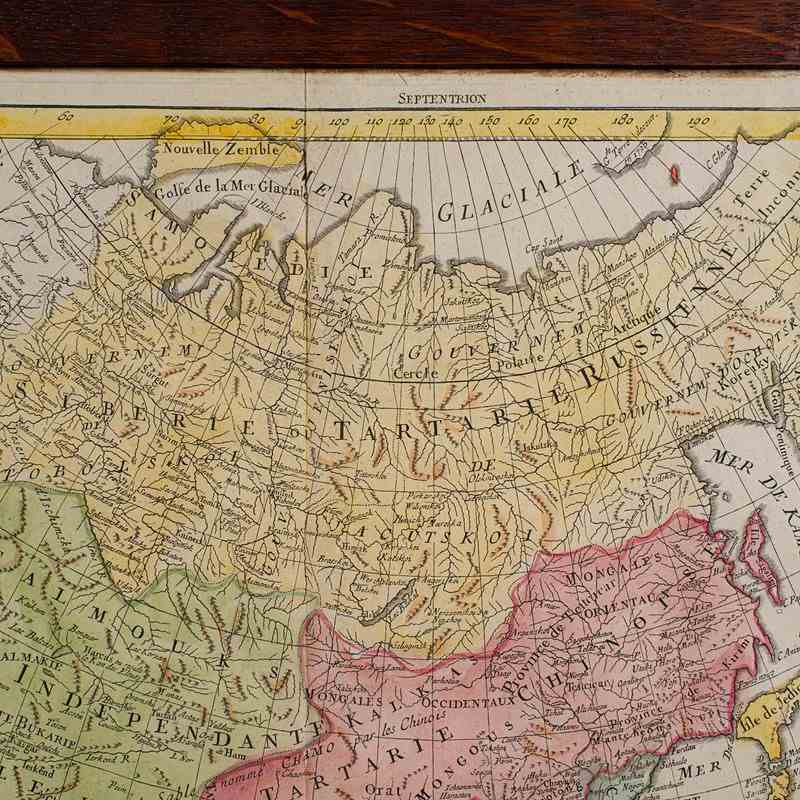
Extends from European Russia to the Oceanic islands
Compiled with islands and territories only tentatively explored in period
Accentuated with an attractive decorative title to the lower left
This is a fine antique map of Asia, framed for display or as an addition to a collection of historic cartography. Delivered ready for the home.
Dimensions:
Max Width: 73cm (28.75'')
Max Depth: 2.5cm (1'')
Max Height: 55cm (21.75'')
Map Width: 67cm (26.5'')
Map Height: 49cm (19.25'')
Item Info
Seller
Seller Location
Hele, Devon
Item Dimensions
H: 55cm W: 73cm D: 2.5cm
Period
1800s
Item Location
United Kingdom
Seller Location
Hele, Devon
Item Location
United Kingdom
Seller Contact No
+44 (0)207 1833511
More from LONDON FINE ANTIQUES