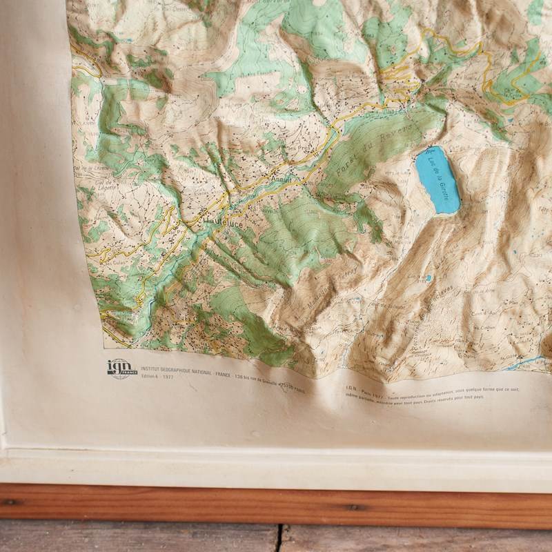
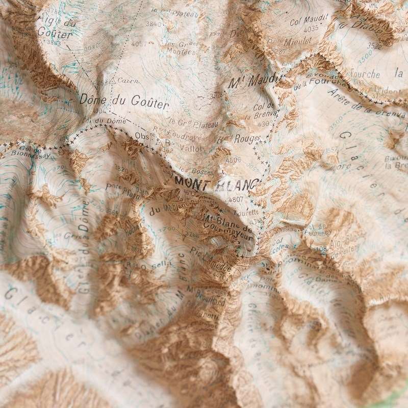

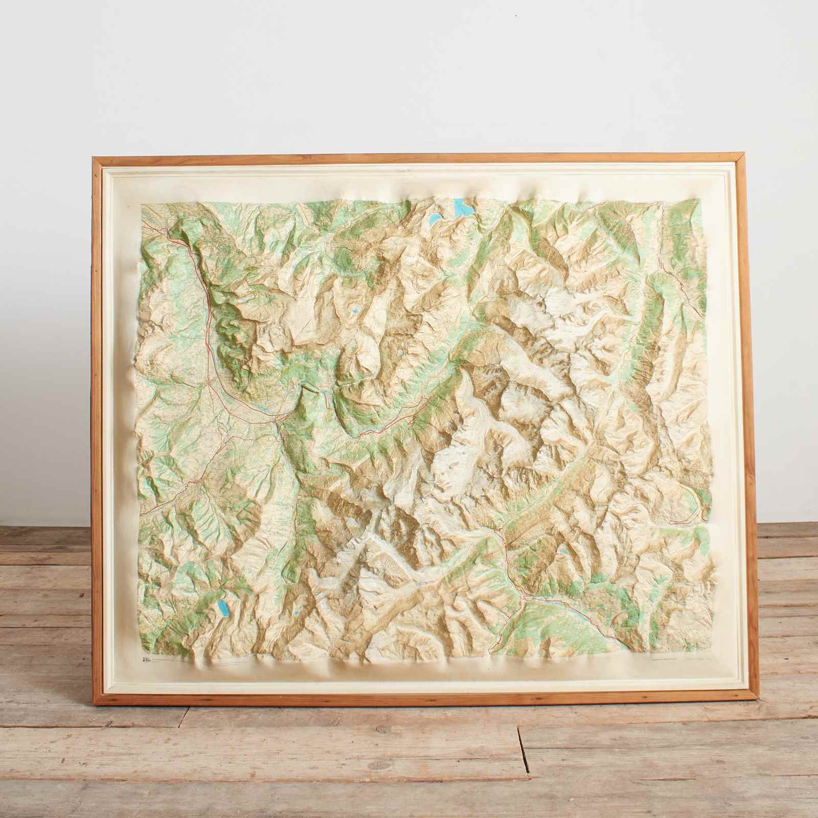
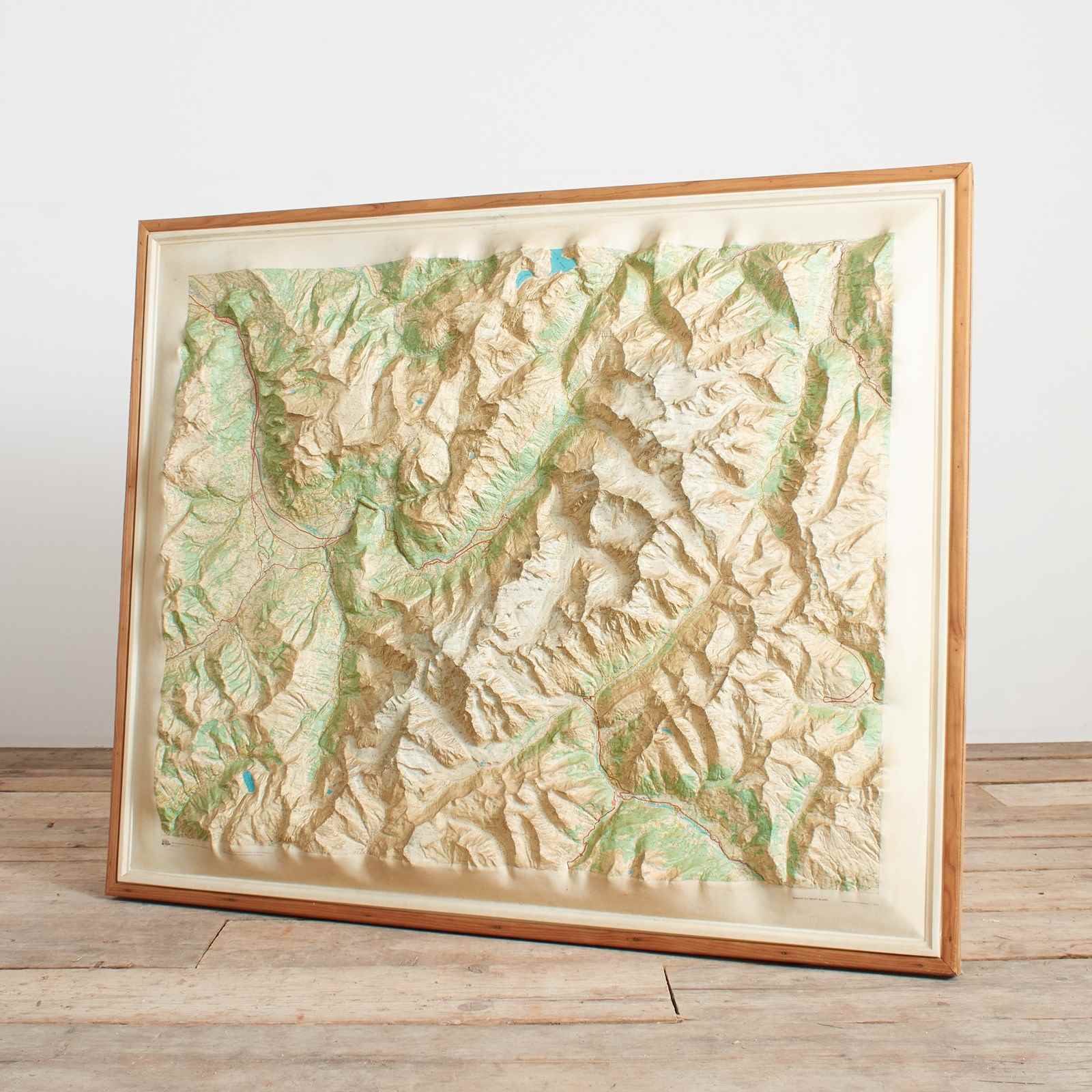

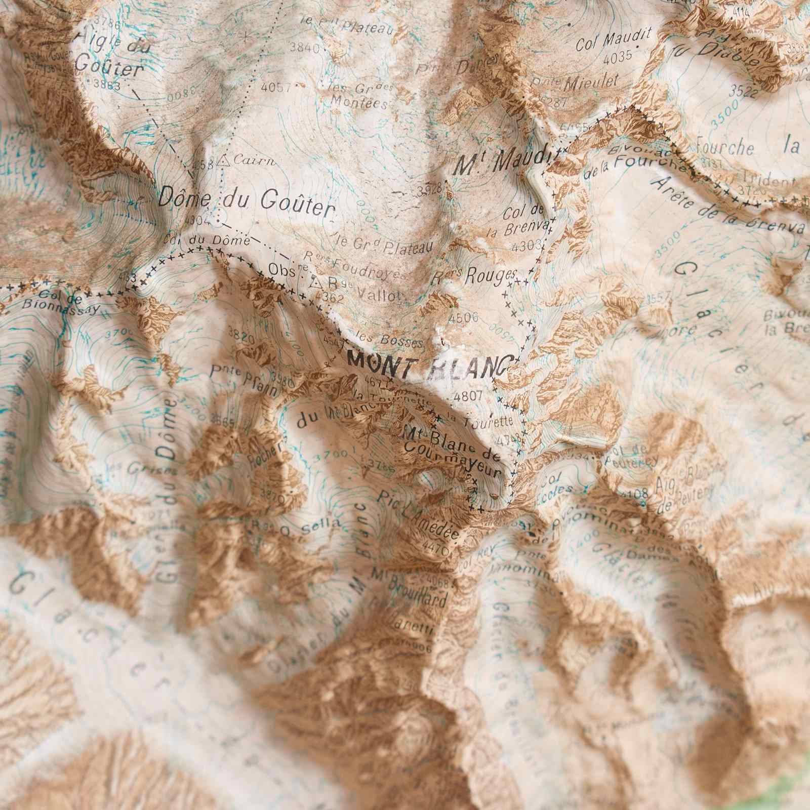

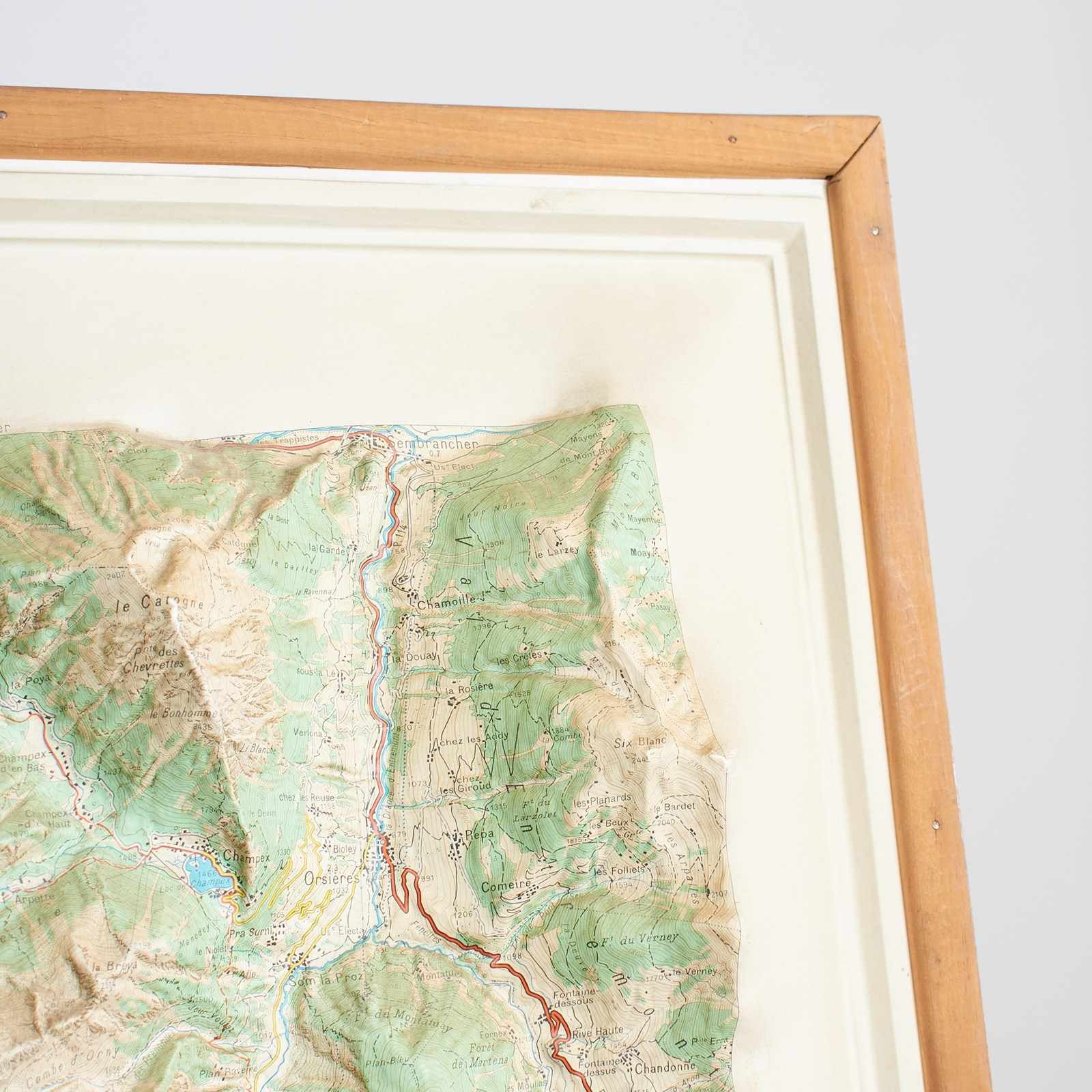
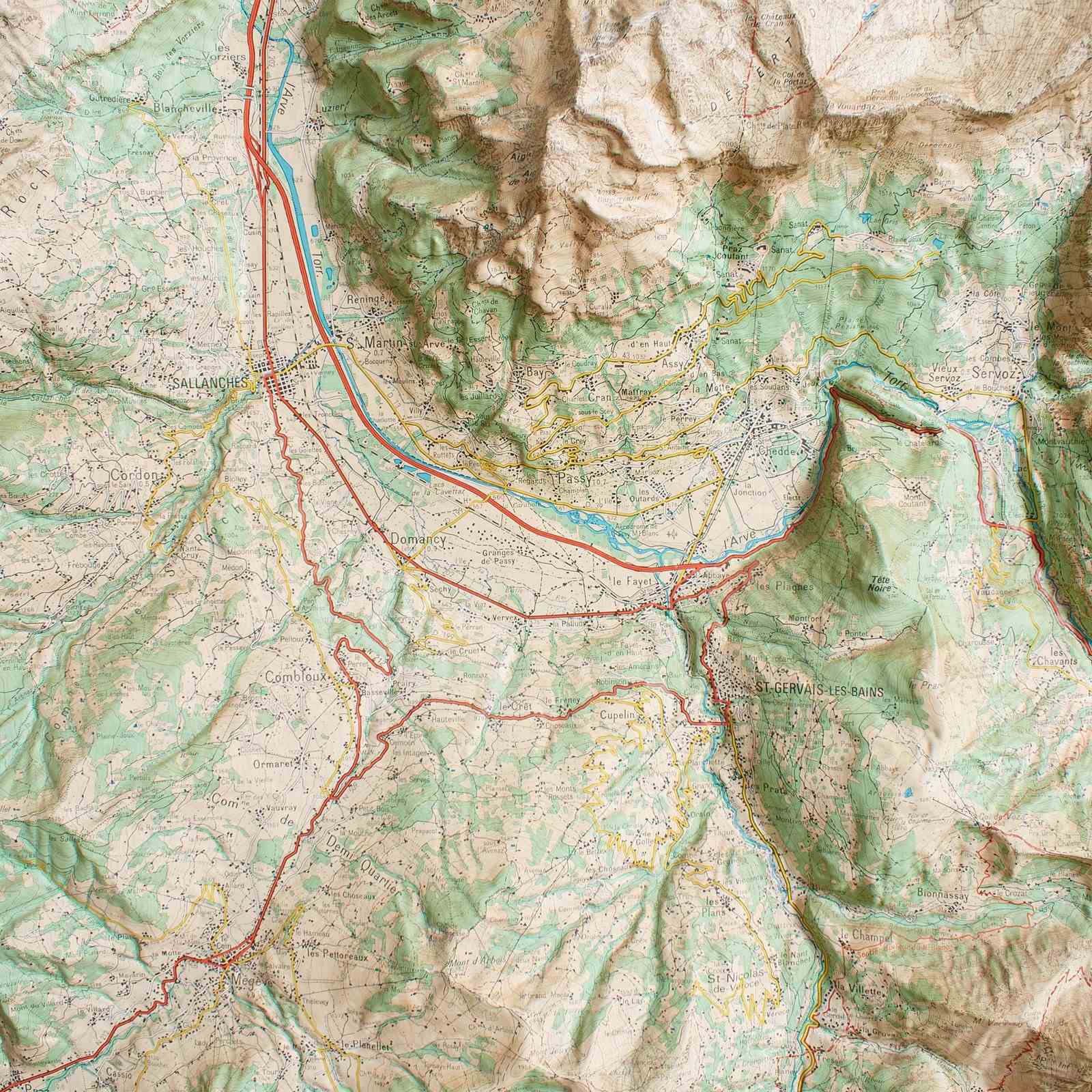
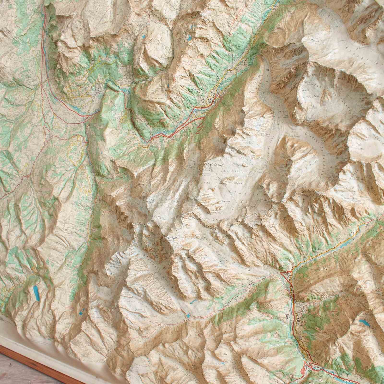
Vintage French Raised Relief Map – Mont Blanc Massif
Stock No
mv5241
2015
- £295.00
- €345 Euro
- $393 US Dollar
Questions about this item?
Like this item?
Item Description
Vintage French Raised Relief Map – Mont Blanc Massif
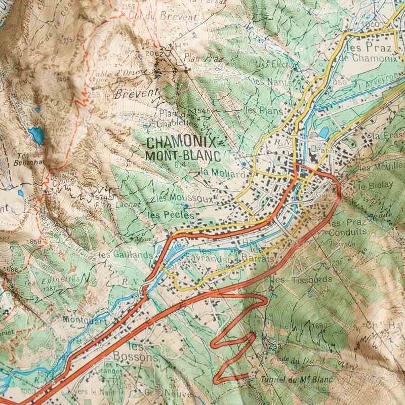
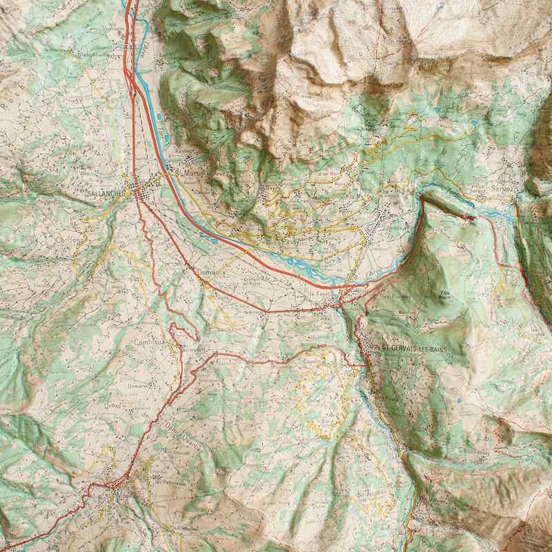
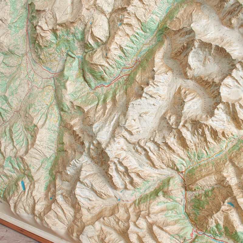
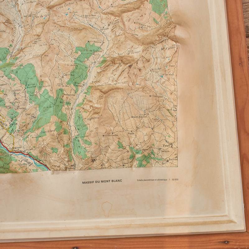
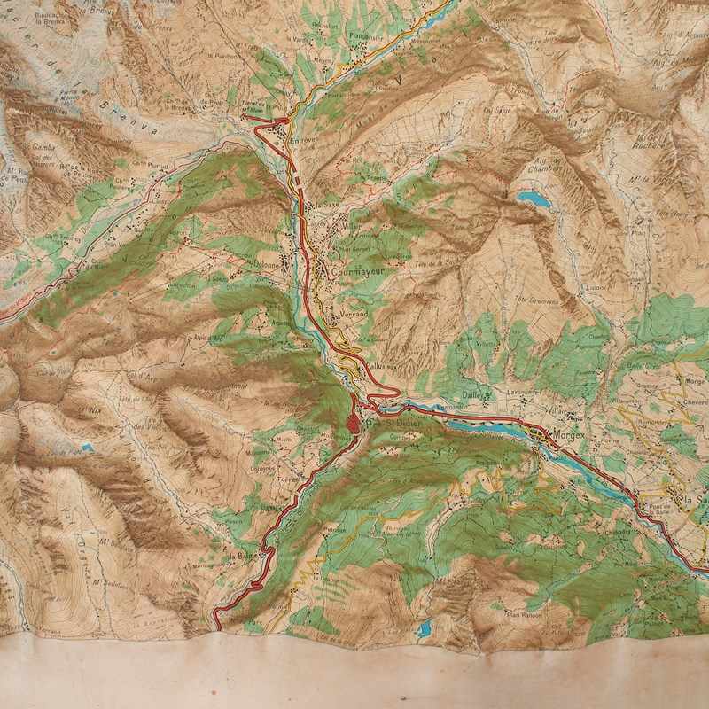
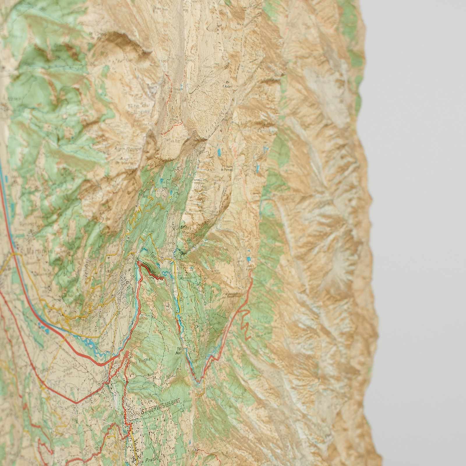
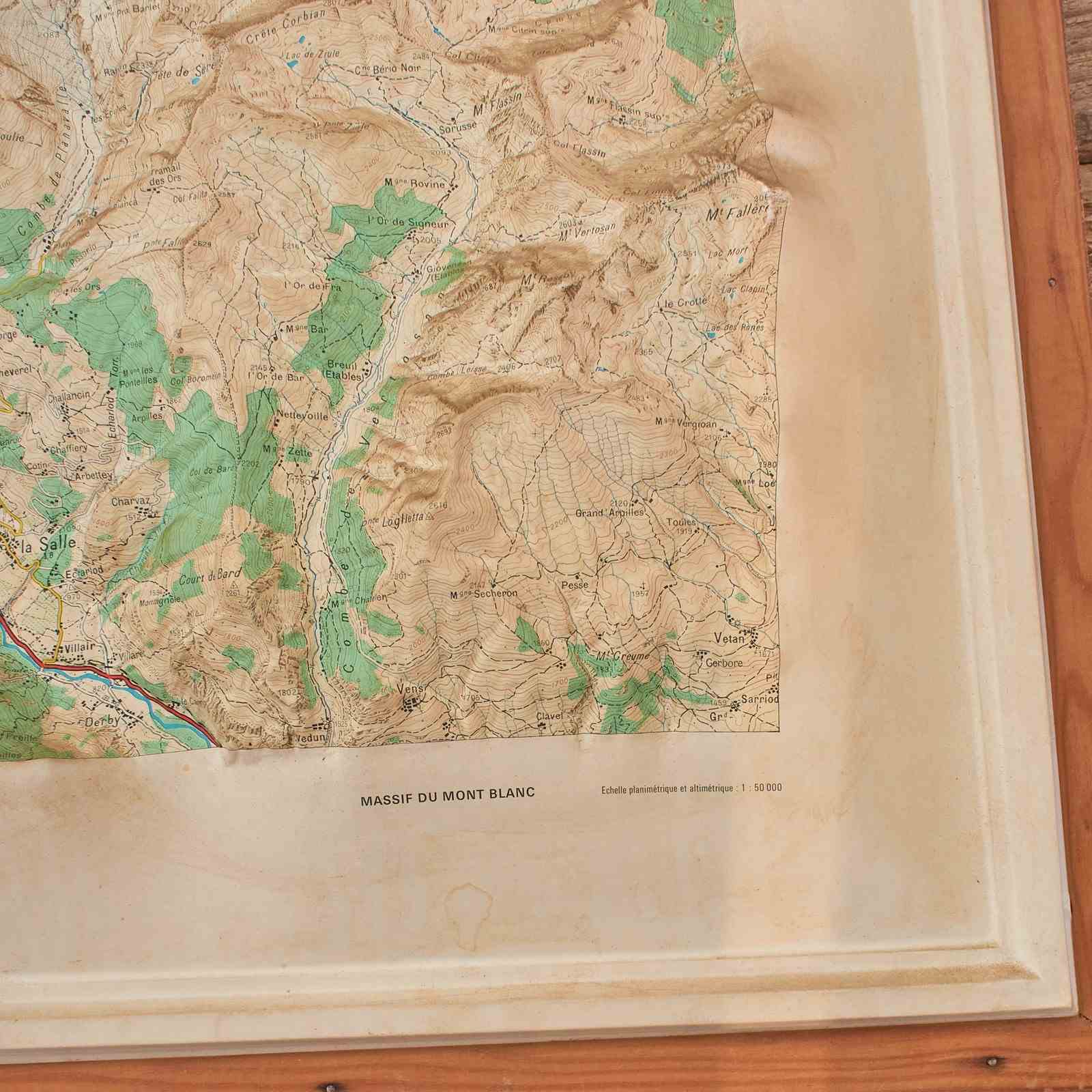
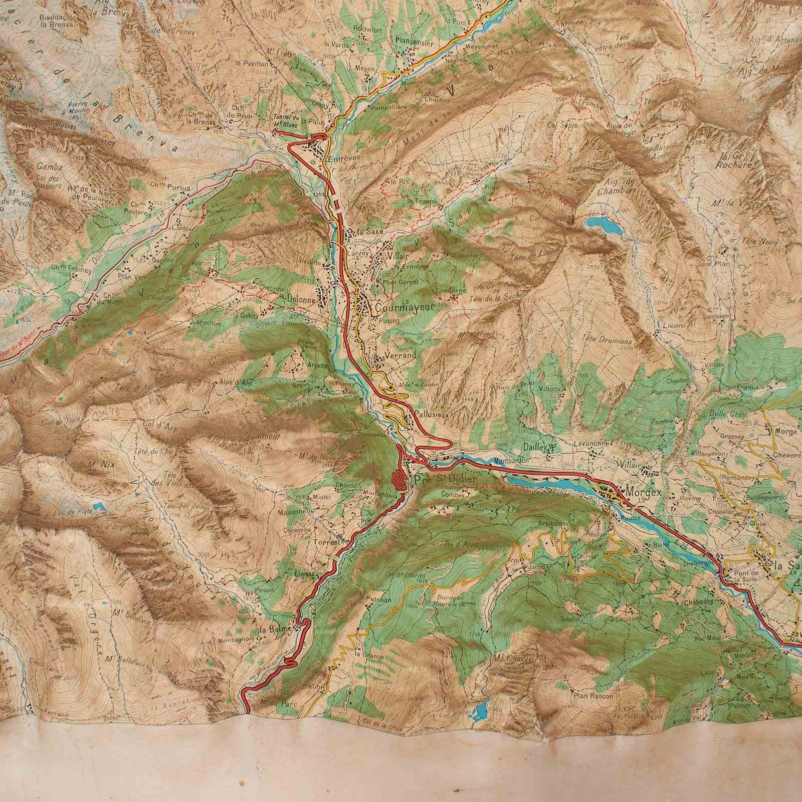
A vintage 3D raised relief map of the French Alps, specifically capturing the dramatic topography of the Mont Blanc Massif. The map covers the region surrounding Mont Blanc, including the well known climbing and ski locations of the Évasion Mont-Blanc, Chamonix-Mont-Blanc, Courmayeur.
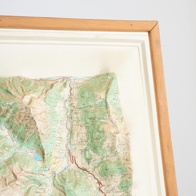
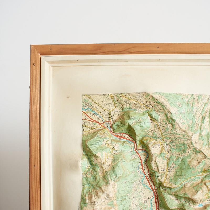
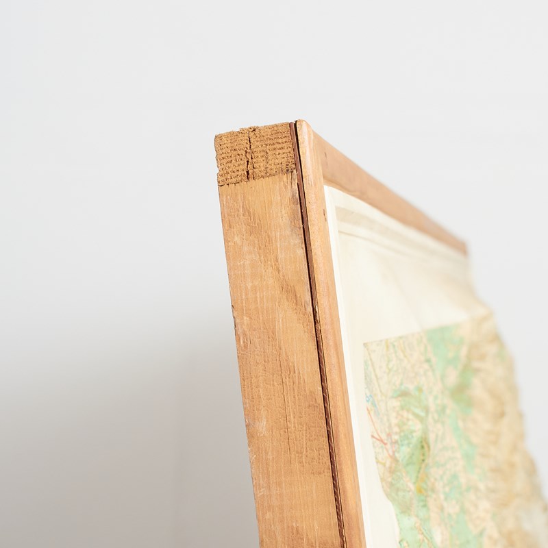
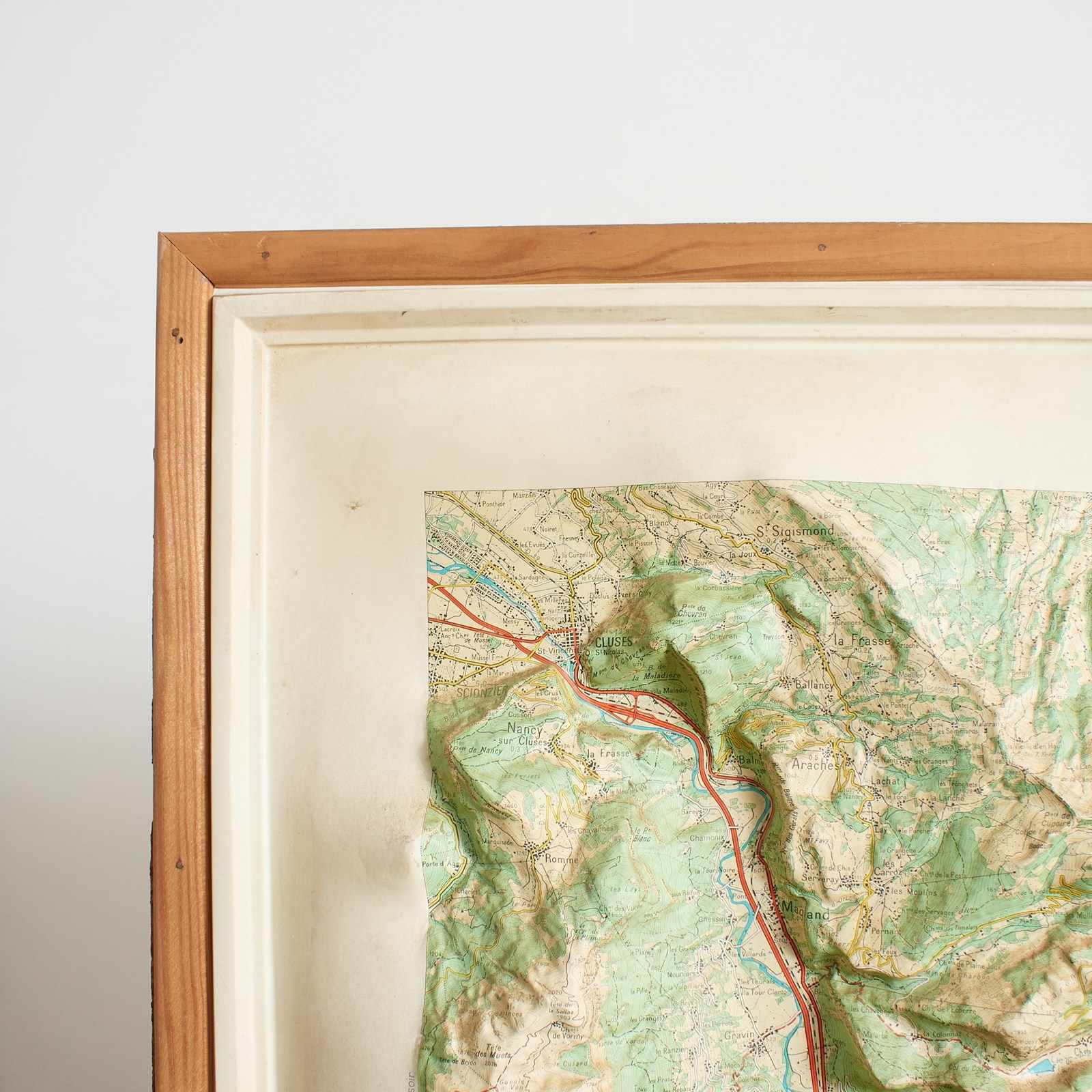
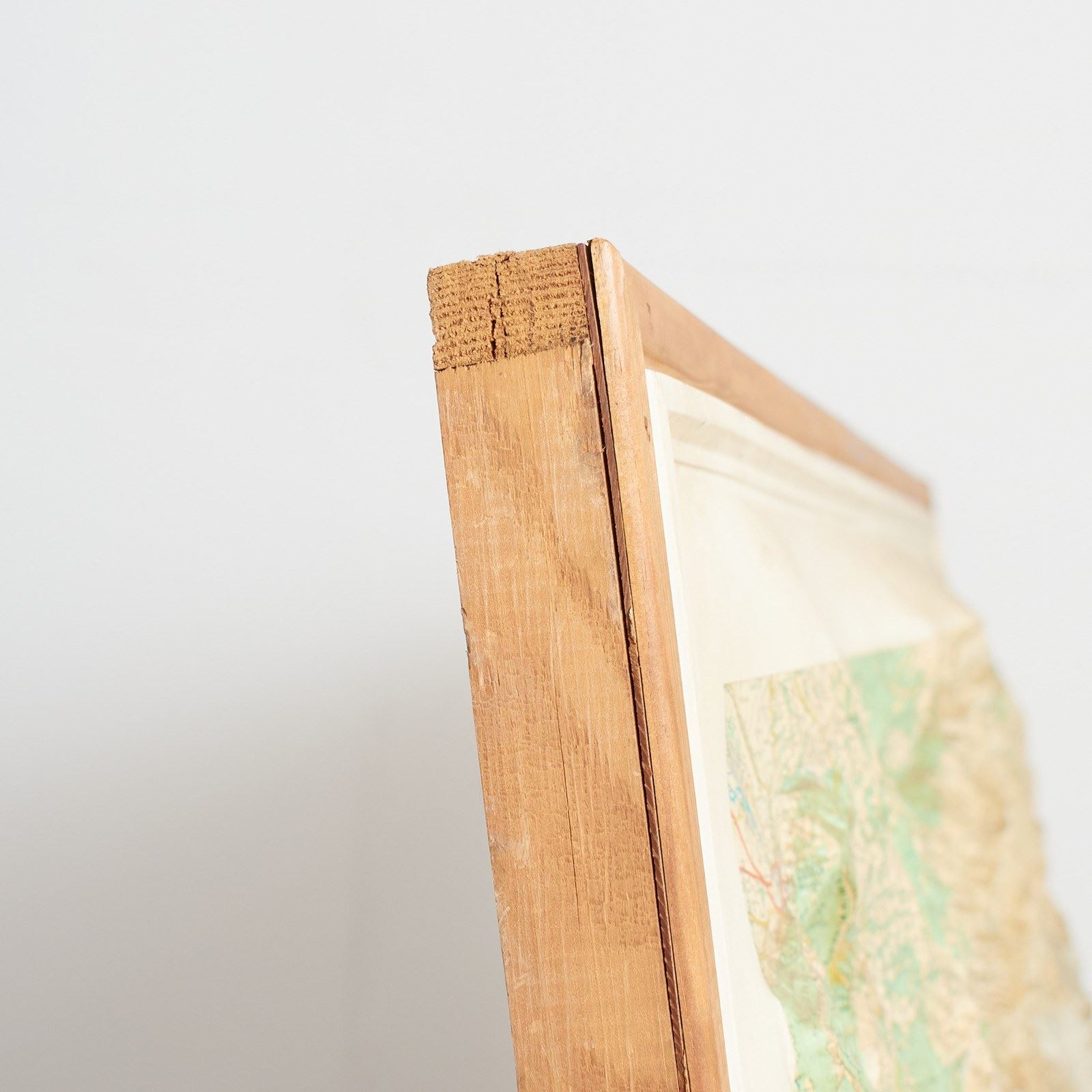
The map is produced by the renowned cartographer IGN – Institut national de l’information géographique France and is stamped on the map with the date 1977 and the region ‘Massif de Mont Blanc’. The map is plastic mounted onto a wooden backboard and frame and can be supplied ready to hang on the wall.
Scale – 1:50,000
Origin: University Lille, France
Circa: 1970s
Workshop Report: The map is in good condition, some minor discolouration to the edges in places.
As with all our products, this product is an original vintage item so there are signs of wear from use.
Item Info
Seller
Seller Location
Wiltshire, Wiltshire
Item Dimensions
H: 98cm W: 117.5cm
Period
Fourth quarter 20th Century
Item Location
United Kingdom
Seller Location
Wiltshire, Wiltshire
Item Location
United Kingdom
Seller Contact No
+44 (0)7801 199131
More from MAYFLY VINTAGE